You are here: Home > Network List > US - United States National Seismic Network Stations List
> Station SCIA State Center, Iowa, USA > Earthquake Result Viewer
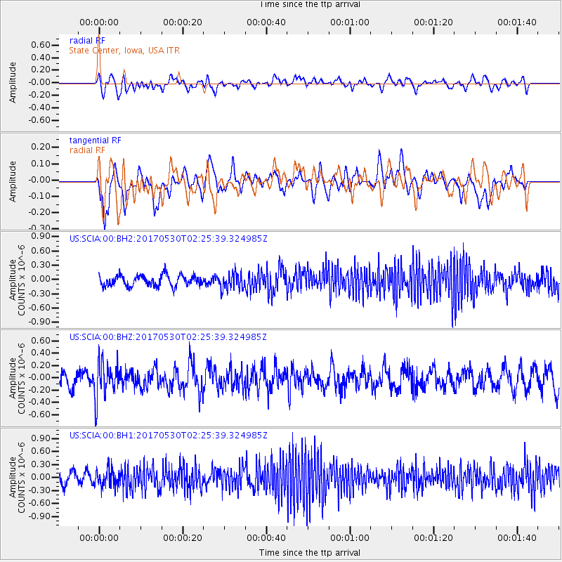
SCIA State Center, Iowa, USA - Earthquake Result Viewer
*The percent match for this event was below the threshold and hence no stack was calculated.
| Earthquake location: |
Kenai Peninsula, Alaska |
| Earthquake latitude/longitude: |
60.8/-151.8 |
| Earthquake time(UTC): |
2017/05/30 (150) 02:18:45 GMT |
| Earthquake Depth: |
78 km |
| Earthquake Magnitude: |
5.2 Mww |
| Earthquake Catalog/Contributor: |
NEIC PDE/ak |
|
| Network: |
US United States National Seismic Network |
| Station: |
SCIA State Center, Iowa, USA |
| Lat/Lon: |
41.91 N/93.22 W |
| Elevation: |
312 m |
|
| Distance: |
39.6 deg |
| Az: |
91.172 deg |
| Baz: |
319.005 deg |
| Ray Param: |
$rayparam |
*The percent match for this event was below the threshold and hence was not used in the summary stack. |
|
| Radial Match: |
50.546555 % |
| Radial Bump: |
400 |
| Transverse Match: |
60.806038 % |
| Transverse Bump: |
400 |
| SOD ConfigId: |
2140511 |
| Insert Time: |
2017-06-20 22:34:21.114 +0000 |
| GWidth: |
2.5 |
| Max Bumps: |
400 |
| Tol: |
0.001 |
|
Signal To Noise
| Channel | StoN | STA | LTA |
| US:SCIA:00:BHZ:20170530T02:25:39.324985Z | 1.9873421 | 2.979769E-7 | 1.4993739E-7 |
| US:SCIA:00:BH1:20170530T02:25:39.324985Z | 1.4517494 | 1.9950768E-7 | 1.374257E-7 |
| US:SCIA:00:BH2:20170530T02:25:39.324985Z | 1.5165621 | 1.7098334E-7 | 1.1274404E-7 |
| Arrivals |
| Ps | |
| PpPs | |
| PsPs/PpSs | |


