TKM2 KN.TKM2 - Earthquake Result Viewer
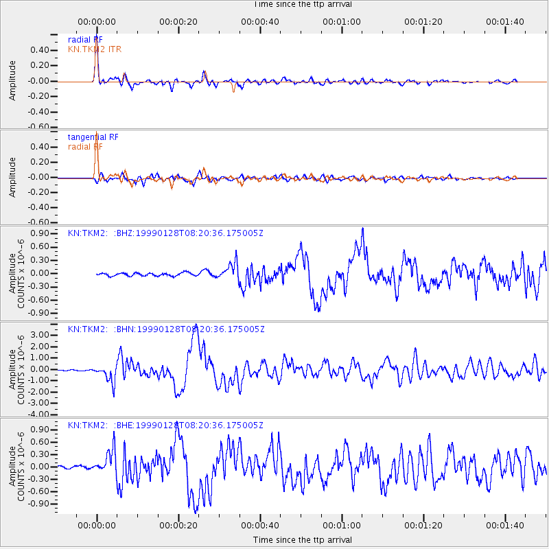
Earthquake location: Fox Islands, Aleutian Islands
Earthquake latitude/longitude: 52.9/-169.1
Earthquake time(UTC): 1999/01/28 (028) 08:10:05 GMT
Earthquake Depth: 67 km
Earthquake Magnitude: 6.3 MB, 6.1 MS, 6.6 MW, 6.6 ME
Earthquake Catalog/Contributor: WHDF/NEIC
Network: KN Kyrgyz Seismic Telemetry Network
Station: TKM2 KN.TKM2
Lat/Lon: 42.92 N/75.60 E
Elevation: 2020 m
Distance: 69.5 deg
Az: 314.848 deg
Baz: 35.793 deg
Ray Param: 0.05543073
Estimated Moho Depth: 17.75 km
Estimated Crust Vp/Vs: 1.61
Assumed Crust Vp: 6.306 km/s
Estimated Crust Vs: 3.929 km/s
Estimated Crust Poisson's Ratio: 0.18
Radial Match: 96.47245 %
Radial Bump: 400
Transverse Match: 89.776924 %
Transverse Bump: 400
SOD ConfigId: 4480
Insert Time: 2010-03-08 20:50:11.168 +0000
GWidth: 2.5
Max Bumps: 400
Tol: 0.001

Signal To Noise

ChannelStoNSTALTA
KN:TKM2: :BHN:19990128T08:20:36.175005Z21.1607347.495539E-73.5421927E-8
KN:TKM2: :BHE:19990128T08:20:36.175005Z6.3533283.1796546E-75.004707E-8
KN:TKM2: :BHZ:19990128T08:20:36.175005Z5.76818041.8956376E-73.2863703E-8
Arrivals
Ps1.8 SECOND
PpPs7.0 SECOND
PsPs/PpSs8.8 SECOND