You are here: Home > Network List > IU - Global Seismograph Network (GSN - IRIS/USGS) Stations List
> Station PMG Port Moresby, New Guinea > Earthquake Result Viewer
PMG Port Moresby, New Guinea - Earthquake Result Viewer
*The percent match for this event was below the threshold and hence no stack was calculated.
| Earthquake location: |
Bali Sea |
| Earthquake latitude/longitude: |
-7.0/116.9 |
| Earthquake time(UTC): |
2020/06/03 (155) 15:54:04 GMT |
| Earthquake Depth: |
640 km |
| Earthquake Magnitude: |
5.7 Mww |
| Earthquake Catalog/Contributor: |
NEIC PDE/us |
|
| Network: |
IU Global Seismograph Network (GSN - IRIS/USGS) |
| Station: |
PMG Port Moresby, New Guinea |
| Lat/Lon: |
9.40 S/147.16 E |
| Elevation: |
90 m |
|
| Distance: |
30.0 deg |
| Az: |
96.623 deg |
| Baz: |
272.228 deg |
| Ray Param: |
$rayparam |
*The percent match for this event was below the threshold and hence was not used in the summary stack. |
|
| Radial Match: |
66.48507 % |
| Radial Bump: |
400 |
| Transverse Match: |
55.373055 % |
| Transverse Bump: |
400 |
| SOD ConfigId: |
21166931 |
| Insert Time: |
2020-06-17 15:58:20.251 +0000 |
| GWidth: |
2.5 |
| Max Bumps: |
400 |
| Tol: |
0.001 |
|
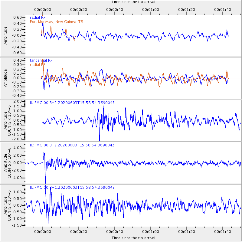
Signal To Noise
| Channel | StoN | STA | LTA |
| IU:PMG:00:BHZ:20200603T15:58:54.369004Z | 6.2300525 | 1.6262298E-6 | 2.6102987E-7 |
| IU:PMG:00:BH1:20200603T15:58:54.369004Z | 2.851608 | 6.6544374E-7 | 2.3335735E-7 |
| IU:PMG:00:BH2:20200603T15:58:54.369004Z | 3.5062072 | 8.000028E-7 | 2.2816756E-7 |
| Arrivals |
| Ps | |
| PpPs | |
| PsPs/PpSs | |


