
TKM2 KN.TKM2 - Earthquake Result Viewer
| ||||||||||||||||||
| ||||||||||||||||||
| ||||||||||||||||||
|
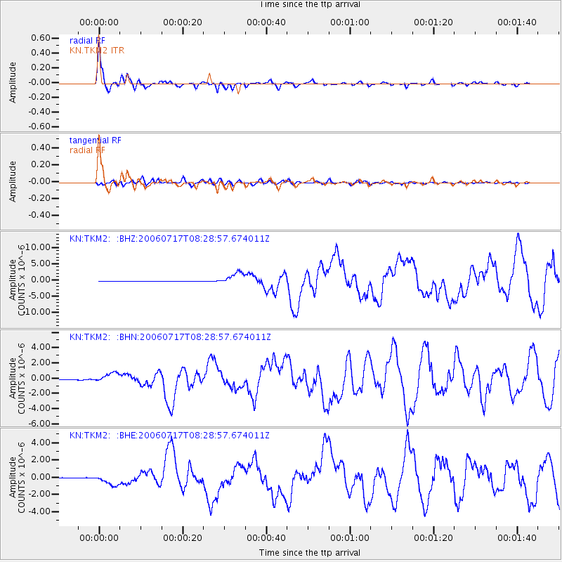
Signal To Noise
| Channel | StoN | STA | LTA |
| KN:TKM2: :BHN:20060717T08:28:57.674011Z | 10.531159 | 6.397556E-7 | 6.0748825E-8 |
| KN:TKM2: :BHE:20060717T08:28:57.674011Z | 22.05702 | 6.3233733E-7 | 2.8668303E-8 |
| KN:TKM2: :BHZ:20060717T08:28:57.674011Z | 58.326904 | 1.9713405E-6 | 3.3798134E-8 |
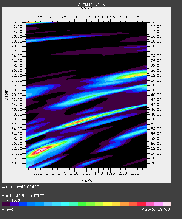
| Arrivals | |
| Ps | 6.9 SECOND |
| PpPs | 25 SECOND |
| PsPs/PpSs | 32 SECOND |

