
TKM2 KN.TKM2 - Earthquake Result Viewer
| ||||||||||||||||||
| ||||||||||||||||||
| ||||||||||||||||||
|
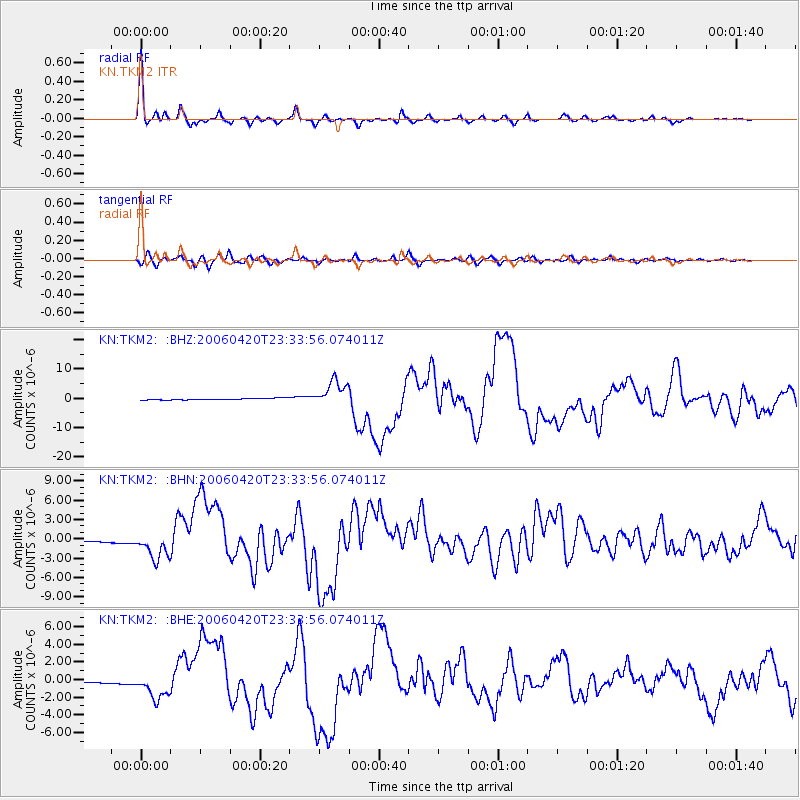
Signal To Noise
| Channel | StoN | STA | LTA |
| KN:TKM2: :BHN:20060420T23:33:56.074011Z | 15.430059 | 2.0694526E-6 | 1.3411825E-7 |
| KN:TKM2: :BHE:20060420T23:33:56.074011Z | 12.8063345 | 1.4739278E-6 | 1.15093655E-7 |
| KN:TKM2: :BHZ:20060420T23:33:56.074011Z | 16.41182 | 4.3286664E-6 | 2.6375298E-7 |
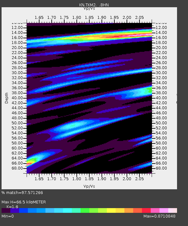
| Arrivals | |
| Ps | 6.7 SECOND |
| PpPs | 26 SECOND |
| PsPs/PpSs | 33 SECOND |

