You are here: Home > Network List > TA - USArray Transportable Network (new EarthScope stations) Stations List
> Station G16K Koyuk River, AK, USA > Earthquake Result Viewer
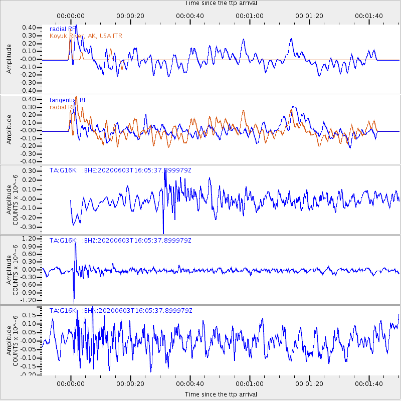
G16K Koyuk River, AK, USA - Earthquake Result Viewer
*The percent match for this event was below the threshold and hence no stack was calculated.
| Earthquake location: |
Bali Sea |
| Earthquake latitude/longitude: |
-7.0/116.9 |
| Earthquake time(UTC): |
2020/06/03 (155) 15:54:04 GMT |
| Earthquake Depth: |
640 km |
| Earthquake Magnitude: |
5.7 Mww |
| Earthquake Catalog/Contributor: |
NEIC PDE/us |
|
| Network: |
TA USArray Transportable Network (new EarthScope stations) |
| Station: |
G16K Koyuk River, AK, USA |
| Lat/Lon: |
65.39 N/162.35 W |
| Elevation: |
169 m |
|
| Distance: |
92.5 deg |
| Az: |
24.434 deg |
| Baz: |
258.7 deg |
| Ray Param: |
$rayparam |
*The percent match for this event was below the threshold and hence was not used in the summary stack. |
|
| Radial Match: |
41.14088 % |
| Radial Bump: |
400 |
| Transverse Match: |
48.6404 % |
| Transverse Bump: |
400 |
| SOD ConfigId: |
21166931 |
| Insert Time: |
2020-06-17 16:00:51.045 +0000 |
| GWidth: |
2.5 |
| Max Bumps: |
400 |
| Tol: |
0.001 |
|
Signal To Noise
| Channel | StoN | STA | LTA |
| TA:G16K: :BHZ:20200603T16:05:37.899979Z | 6.176733 | 3.8257693E-7 | 6.1938394E-8 |
| TA:G16K: :BHN:20200603T16:05:37.899979Z | 1.3562654 | 8.2747434E-8 | 6.101124E-8 |
| TA:G16K: :BHE:20200603T16:05:37.899979Z | 1.9563051 | 1.6326301E-7 | 8.345478E-8 |
| Arrivals |
| Ps | |
| PpPs | |
| PsPs/PpSs | |


