You are here: Home > Network List > TA - USArray Transportable Network (new EarthScope stations) Stations List
> Station L15K Ungalak Mountain, AK, USA > Earthquake Result Viewer
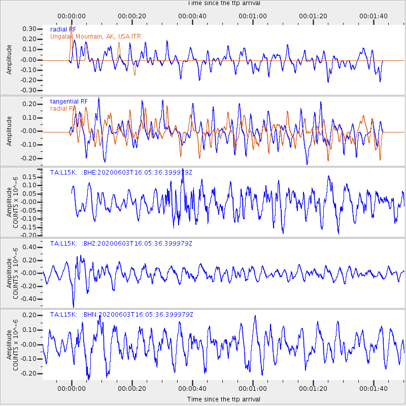
L15K Ungalak Mountain, AK, USA - Earthquake Result Viewer
*The percent match for this event was below the threshold and hence no stack was calculated.
| Earthquake location: |
Bali Sea |
| Earthquake latitude/longitude: |
-7.0/116.9 |
| Earthquake time(UTC): |
2020/06/03 (155) 15:54:04 GMT |
| Earthquake Depth: |
640 km |
| Earthquake Magnitude: |
5.7 Mww |
| Earthquake Catalog/Contributor: |
NEIC PDE/us |
|
| Network: |
TA USArray Transportable Network (new EarthScope stations) |
| Station: |
L15K Ungalak Mountain, AK, USA |
| Lat/Lon: |
61.68 N/161.49 W |
| Elevation: |
219 m |
|
| Distance: |
92.2 deg |
| Az: |
28.173 deg |
| Baz: |
259.325 deg |
| Ray Param: |
$rayparam |
*The percent match for this event was below the threshold and hence was not used in the summary stack. |
|
| Radial Match: |
56.259293 % |
| Radial Bump: |
400 |
| Transverse Match: |
61.814507 % |
| Transverse Bump: |
400 |
| SOD ConfigId: |
21166931 |
| Insert Time: |
2020-06-17 16:01:10.893 +0000 |
| GWidth: |
2.5 |
| Max Bumps: |
400 |
| Tol: |
0.001 |
|
Signal To Noise
| Channel | StoN | STA | LTA |
| TA:L15K: :BHZ:20200603T16:05:36.399979Z | 2.4229124 | 2.0718686E-7 | 8.5511495E-8 |
| TA:L15K: :BHN:20200603T16:05:36.399979Z | 1.2329948 | 7.33997E-8 | 5.9529604E-8 |
| TA:L15K: :BHE:20200603T16:05:36.399979Z | 1.2376833 | 6.392878E-8 | 5.1651973E-8 |
| Arrivals |
| Ps | |
| PpPs | |
| PsPs/PpSs | |


