
TKM2 KN.TKM2 - Earthquake Result Viewer
| ||||||||||||||||||
| ||||||||||||||||||
| ||||||||||||||||||
|
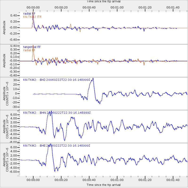
Signal To Noise
| Channel | StoN | STA | LTA |
| KN:TKM2: :BHN:20060222T22:30:16.148999Z | 7.5311103 | 6.2193453E-7 | 8.2582055E-8 |
| KN:TKM2: :BHE:20060222T22:30:16.148999Z | 12.802472 | 4.90221E-7 | 3.829112E-8 |
| KN:TKM2: :BHZ:20060222T22:30:16.148999Z | 32.854233 | 2.2982895E-6 | 6.995413E-8 |
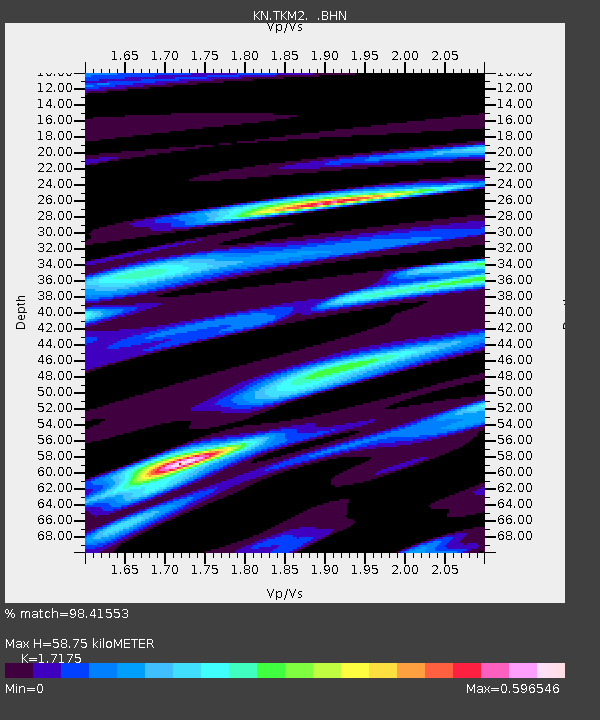
| Arrivals | |
| Ps | 6.9 SECOND |
| PpPs | 25 SECOND |
| PsPs/PpSs | 31 SECOND |

