
TKM2 KN.TKM2 - Earthquake Result Viewer
| ||||||||||||||||||
| ||||||||||||||||||
| ||||||||||||||||||
|
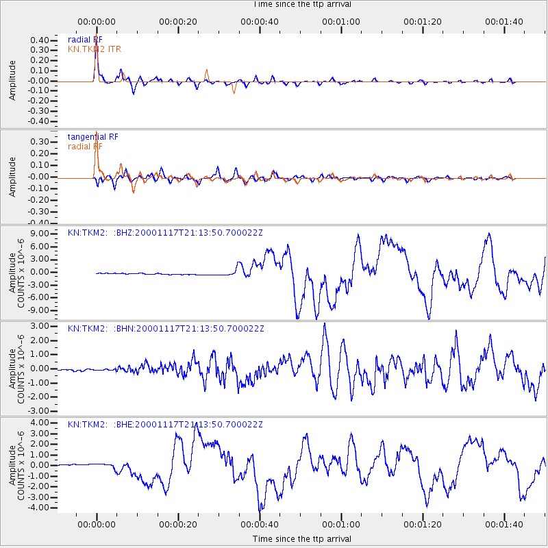
Signal To Noise
| Channel | StoN | STA | LTA |
| KN:TKM2: :BHN:20001117T21:13:50.700022Z | 0.73550415 | 6.577095E-8 | 8.942295E-8 |
| KN:TKM2: :BHE:20001117T21:13:50.700022Z | 3.1071732 | 2.2599745E-7 | 7.27341E-8 |
| KN:TKM2: :BHZ:20001117T21:13:50.700022Z | 6.6039395 | 8.3985816E-7 | 1.2717533E-7 |
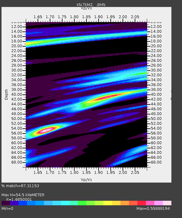
| Arrivals | |
| Ps | 6.1 SECOND |
| PpPs | 23 SECOND |
| PsPs/PpSs | 29 SECOND |

