
TKM2 KN.TKM2 - Earthquake Result Viewer
| ||||||||||||||||||
| ||||||||||||||||||
| ||||||||||||||||||
|
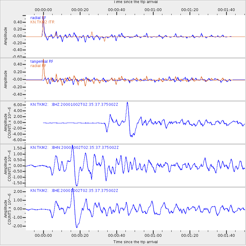
Signal To Noise
| Channel | StoN | STA | LTA |
| KN:TKM2: :BHN:20001002T02:35:37.375002Z | 5.7855134 | 2.4453092E-7 | 4.226607E-8 |
| KN:TKM2: :BHE:20001002T02:35:37.375002Z | 8.277386 | 2.9384424E-7 | 3.5499642E-8 |
| KN:TKM2: :BHZ:20001002T02:35:37.375002Z | 27.853071 | 9.539682E-7 | 3.4250018E-8 |
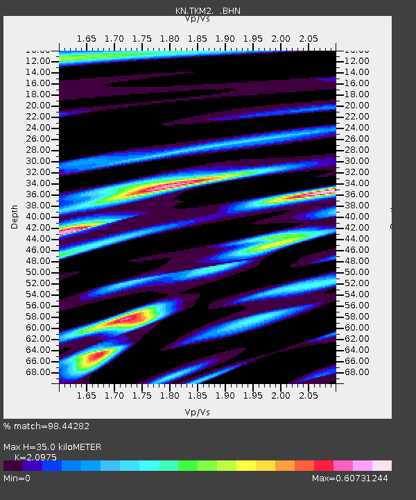
| Arrivals | |
| Ps | 6.3 SECOND |
| PpPs | 17 SECOND |
| PsPs/PpSs | 23 SECOND |

