TKM2 KN.TKM2 - Earthquake Result Viewer
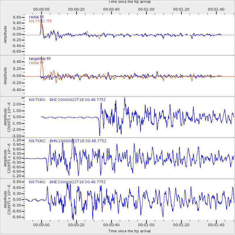
Earthquake location: Southern Sumatra, Indonesia
Earthquake latitude/longitude: -5.0/102.1
Earthquake time(UTC): 2000/09/22 (266) 18:22:03 GMT
Earthquake Depth: 33 km
Earthquake Magnitude: 5.8 MB, 5.9 MS, 6.2 MW, 6.2 MW
Earthquake Catalog/Contributor: WHDF/NEIC
Network: KN Kyrgyz Seismic Telemetry Network
Station: TKM2 KN.TKM2
Lat/Lon: 42.92 N/75.60 E
Elevation: 2020 m
Distance: 53.4 deg
Az: 335.889 deg
Baz: 146.354 deg
Ray Param: 0.06608045
Estimated Moho Depth: 10.0 km
Estimated Crust Vp/Vs: 1.60
Assumed Crust Vp: 6.306 km/s
Estimated Crust Vs: 3.941 km/s
Estimated Crust Poisson's Ratio: 0.18
Radial Match: 96.287476 %
Radial Bump: 400
Transverse Match: 85.88516 %
Transverse Bump: 400
SOD ConfigId: 3744
Insert Time: 2010-03-08 20:53:32.699 +0000
GWidth: 2.5
Max Bumps: 400
Tol: 0.001

Signal To Noise

ChannelStoNSTALTA
KN:TKM2: :BHN:20000922T18:30:48.775Z14.8186273.1796014E-72.1456788E-8
KN:TKM2: :BHE:20000922T18:30:48.775Z7.1125782.1808148E-73.0661386E-8
KN:TKM2: :BHZ:20000922T18:30:48.775Z18.405861.0108665E-65.4920903E-8
Arrivals
Ps1.0 SECOND
PpPs3.9 SECOND
PsPs/PpSs4.9 SECOND