You are here: Home > Network List > CN - Canadian National Seismograph Network Stations List
> Station INK INUVIK, NT > Earthquake Result Viewer
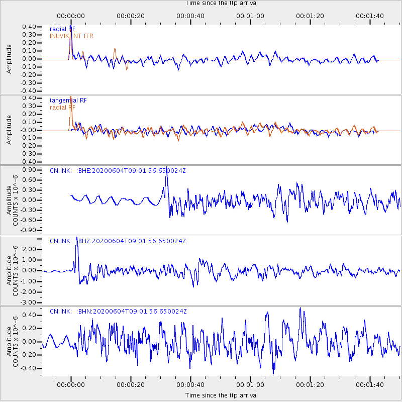
INK INUVIK, NT - Earthquake Result Viewer
*The percent match for this event was below the threshold and hence no stack was calculated.
| Earthquake location: |
Halmahera, Indonesia |
| Earthquake latitude/longitude: |
2.9/128.2 |
| Earthquake time(UTC): |
2020/06/04 (156) 08:49:41 GMT |
| Earthquake Depth: |
127 km |
| Earthquake Magnitude: |
6.7 Mi |
| Earthquake Catalog/Contributor: |
NEIC PDE/at |
|
| Network: |
CN Canadian National Seismograph Network |
| Station: |
INK INUVIK, NT |
| Lat/Lon: |
68.31 N/133.53 W |
| Elevation: |
44 m |
|
| Distance: |
90.4 deg |
| Az: |
21.59 deg |
| Baz: |
278.719 deg |
| Ray Param: |
$rayparam |
*The percent match for this event was below the threshold and hence was not used in the summary stack. |
|
| Radial Match: |
74.20344 % |
| Radial Bump: |
400 |
| Transverse Match: |
58.569283 % |
| Transverse Bump: |
400 |
| SOD ConfigId: |
21166931 |
| Insert Time: |
2020-06-18 08:56:51.976 +0000 |
| GWidth: |
2.5 |
| Max Bumps: |
400 |
| Tol: |
0.001 |
|
Signal To Noise
| Channel | StoN | STA | LTA |
| CN:INK: :BHZ:20200604T09:01:56.650024Z | 10.91111 | 1.1934329E-6 | 1.0937777E-7 |
| CN:INK: :BHN:20200604T09:01:56.650024Z | 1.2449898 | 1.0730784E-7 | 8.619175E-8 |
| CN:INK: :BHE:20200604T09:01:56.650024Z | 4.561427 | 3.5221538E-7 | 7.721605E-8 |
| Arrivals |
| Ps | |
| PpPs | |
| PsPs/PpSs | |


