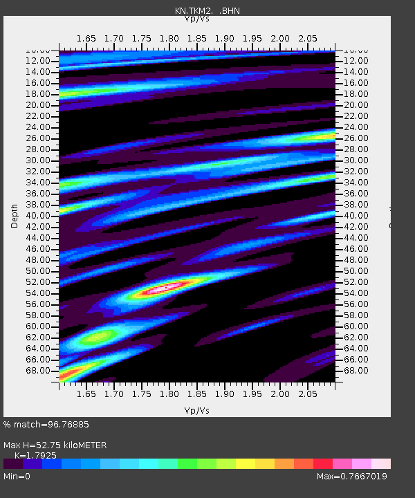
TKM2 KN.TKM2 - Earthquake Result Viewer
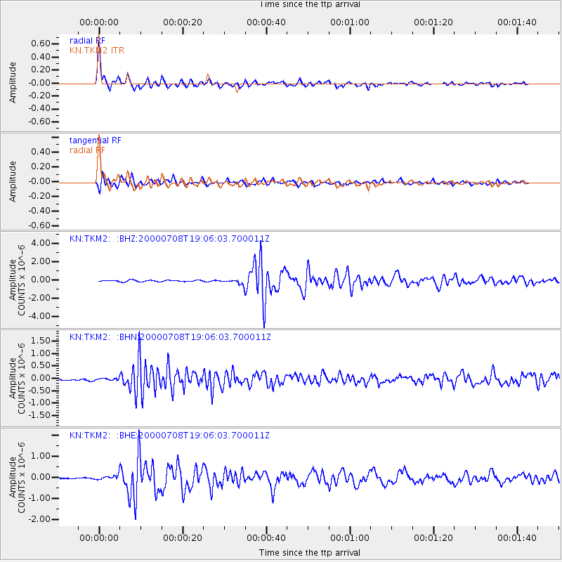
Earthquake location: Near S. Coast Of Honshu, Japan
Earthquake latitude/longitude: 34.1/139.1
Earthquake time(UTC): 2000/07/08 (190) 18:57:44 GMT
Earthquake Depth: 10 km
Earthquake Magnitude: 5.9 MB, 5.6 MS, 6.0 MW, 5.9 MW
Earthquake Catalog/Contributor: WHDF/NEIC
Network: KN Kyrgyz Seismic Telemetry Network
Station: TKM2 KN.TKM2
Lat/Lon: 42.92 N/75.60 E
Elevation: 2020 m
Distance: 49.5 deg
Az: 300.079 deg
Baz: 77.974 deg
Ray Param: 0.06868968
Estimated Moho Depth: 52.75 km
Estimated Crust Vp/Vs: 1.79
Assumed Crust Vp: 6.306 km/s
Estimated Crust Vs: 3.518 km/s
Estimated Crust Poisson's Ratio: 0.27
Radial Match: 96.76885 %
Radial Bump: 317
Transverse Match: 87.0017 %
Transverse Bump: 400
SOD ConfigId: 3744
Insert Time: 2010-03-08 20:54:26.926 +0000
GWidth: 2.5
Max Bumps: 400
Tol: 0.001

Signal To Noise

ChannelStoNSTALTA
KN:TKM2: :BHN:20000708T19:06:03.700011Z0.843629543.4182996E-84.0518962E-8
KN:TKM2: :BHE:20000708T19:06:03.700011Z3.25910021.18840624E-73.6464243E-8
KN:TKM2: :BHZ:20000708T19:06:03.700011Z3.91680173.0637457E-77.8220594E-8
Arrivals
Ps7.0 SECOND
PpPs22 SECOND
PsPs/PpSs29 SECOND