
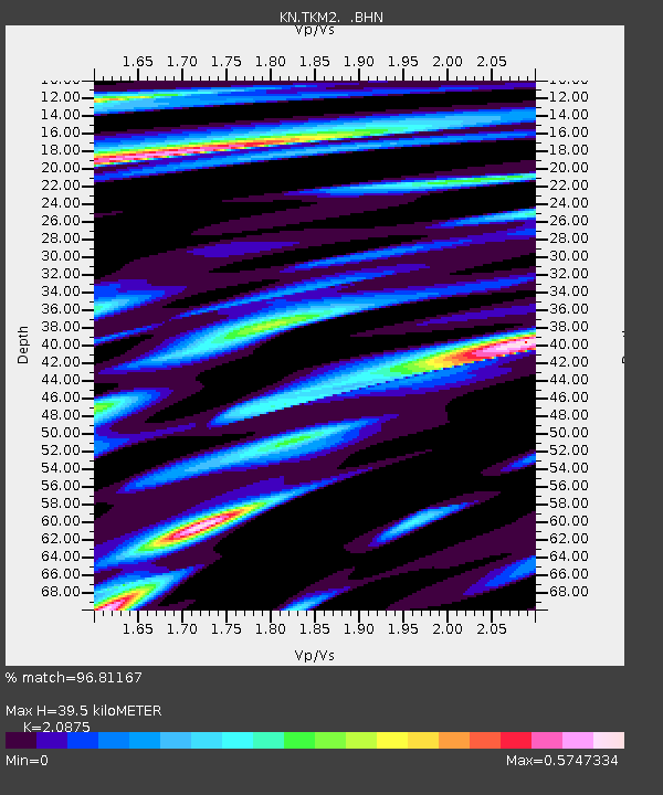
TKM2 KN.TKM2 - Earthquake Result Viewer
| ||||||||||||||||||
| ||||||||||||||||||
| ||||||||||||||||||
|
Signal To Noise
| Channel | StoN | STA | LTA |
| KN:TKM2: :BHN:20000615T11:18:44.625009Z | 1.1698414 | 3.1636397E-8 | 2.7043322E-8 |
| KN:TKM2: :BHE:20000615T11:18:44.625009Z | 1.7469002 | 9.0860745E-8 | 5.2012556E-8 |
| KN:TKM2: :BHZ:20000615T11:18:44.625009Z | 2.7985785 | 1.8196235E-7 | 6.501956E-8 |
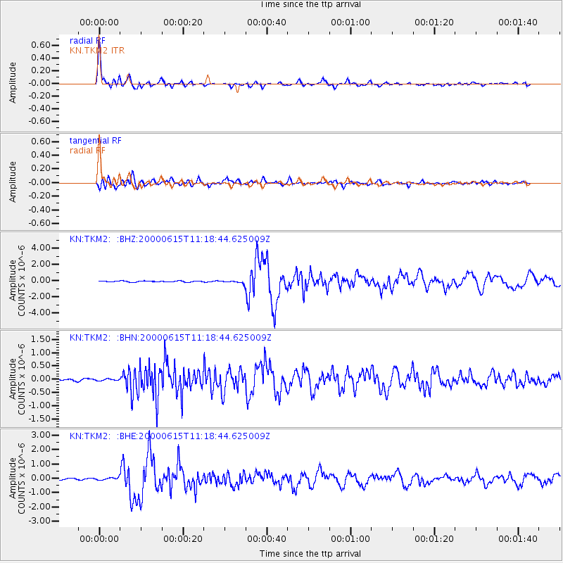
| Arrivals | |
| Ps | 7.2 SECOND |
| PpPs | 18 SECOND |
| PsPs/PpSs | 26 SECOND |

