You are here: Home > Network List > TA - USArray Transportable Network (new EarthScope stations) Stations List
> Station G21K Allakaket, AK, USA > Earthquake Result Viewer
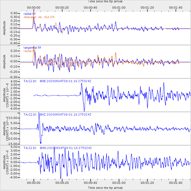
G21K Allakaket, AK, USA - Earthquake Result Viewer
*The percent match for this event was below the threshold and hence no stack was calculated.
| Earthquake location: |
Halmahera, Indonesia |
| Earthquake latitude/longitude: |
2.9/128.2 |
| Earthquake time(UTC): |
2020/06/04 (156) 08:49:41 GMT |
| Earthquake Depth: |
127 km |
| Earthquake Magnitude: |
6.7 Mi |
| Earthquake Catalog/Contributor: |
NEIC PDE/at |
|
| Network: |
TA USArray Transportable Network (new EarthScope stations) |
| Station: |
G21K Allakaket, AK, USA |
| Lat/Lon: |
66.52 N/153.51 W |
| Elevation: |
446 m |
|
| Distance: |
82.7 deg |
| Az: |
23.303 deg |
| Baz: |
260.363 deg |
| Ray Param: |
$rayparam |
*The percent match for this event was below the threshold and hence was not used in the summary stack. |
|
| Radial Match: |
89.11025 % |
| Radial Bump: |
400 |
| Transverse Match: |
92.78179 % |
| Transverse Bump: |
400 |
| SOD ConfigId: |
21166931 |
| Insert Time: |
2020-06-18 09:02:36.752 +0000 |
| GWidth: |
2.5 |
| Max Bumps: |
400 |
| Tol: |
0.001 |
|
Signal To Noise
| Channel | StoN | STA | LTA |
| TA:G21K: :BHZ:20200604T09:01:19.275024Z | 119.51047 | 5.6460976E-6 | 4.7243542E-8 |
| TA:G21K: :BHN:20200604T09:01:19.275024Z | 10.923325 | 7.176743E-7 | 6.570109E-8 |
| TA:G21K: :BHE:20200604T09:01:19.275024Z | 15.095197 | 1.1958882E-6 | 7.92231E-8 |
| Arrivals |
| Ps | |
| PpPs | |
| PsPs/PpSs | |


