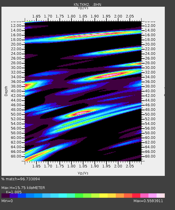
TKM2 KN.TKM2 - Earthquake Result Viewer
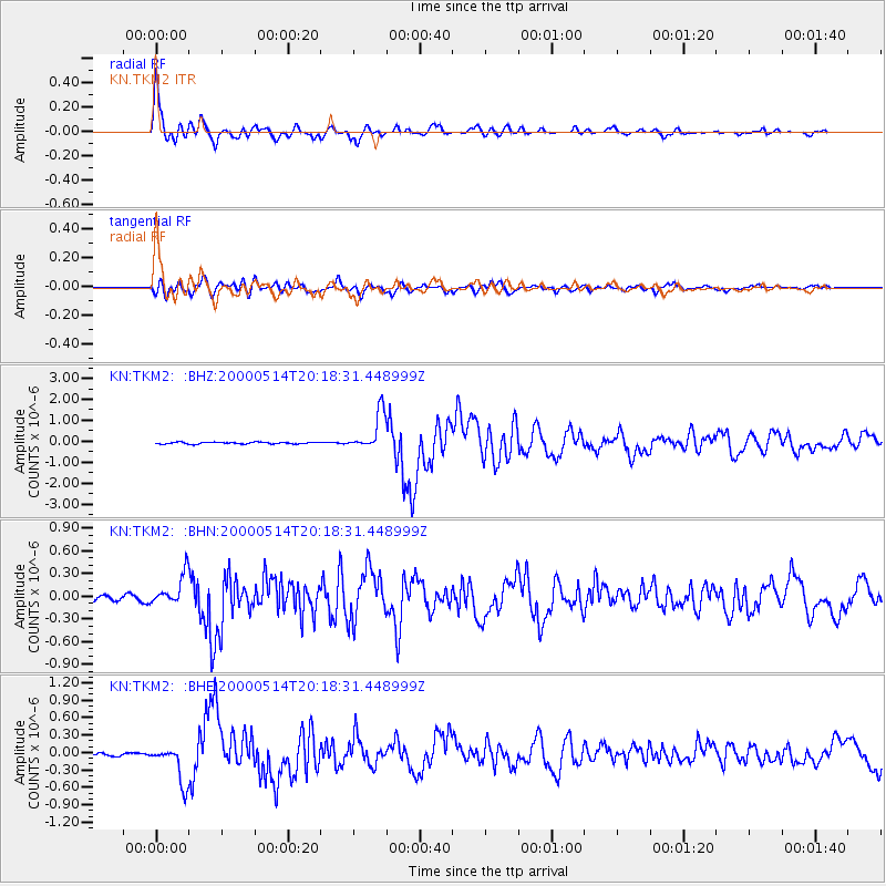
Earthquake location: Banda Sea
Earthquake latitude/longitude: -4.3/123.2
Earthquake time(UTC): 2000/05/14 (135) 20:08:34 GMT
Earthquake Depth: 33 km
Earthquake Magnitude: 5.9 MB, 5.9 MS, 6.3 MW, 6.2 MW
Earthquake Catalog/Contributor: WHDF/NEIC
Network: KN Kyrgyz Seismic Telemetry Network
Station: TKM2 KN.TKM2
Lat/Lon: 42.92 N/75.60 E
Elevation: 2020 m
Distance: 63.7 deg
Az: 322.771 deg
Baz: 124.782 deg
Ray Param: 0.059382156
Estimated Moho Depth: 15.75 km
Estimated Crust Vp/Vs: 1.88
Assumed Crust Vp: 6.306 km/s
Estimated Crust Vs: 3.345 km/s
Estimated Crust Poisson's Ratio: 0.30
Radial Match: 96.733894 %
Radial Bump: 400
Transverse Match: 89.553665 %
Transverse Bump: 400
SOD ConfigId: 3744
Insert Time: 2010-03-08 20:55:04.057 +0000
GWidth: 2.5
Max Bumps: 400
Tol: 0.001

Signal To Noise

ChannelStoNSTALTA
KN:TKM2: :BHN:20000514T20:18:31.448999Z7.710391.9750922E-72.5615984E-8
KN:TKM2: :BHE:20000514T20:18:31.448999Z12.7972143.2461276E-72.5365896E-8
KN:TKM2: :BHZ:20000514T20:18:31.448999Z22.6421729.0889046E-74.014149E-8
Arrivals
Ps2.3 SECOND
PpPs6.9 SECOND
PsPs/PpSs9.2 SECOND