
TKM2 KN.TKM2 - Earthquake Result Viewer
| ||||||||||||||||||
| ||||||||||||||||||
| ||||||||||||||||||
|
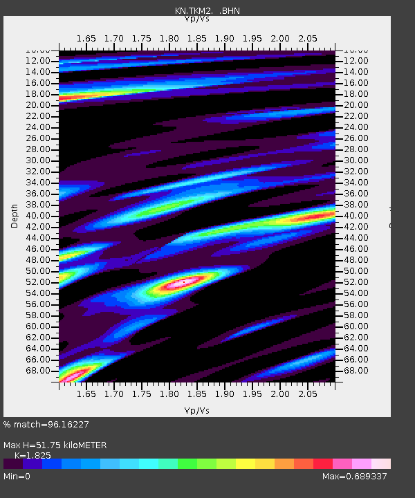
Signal To Noise
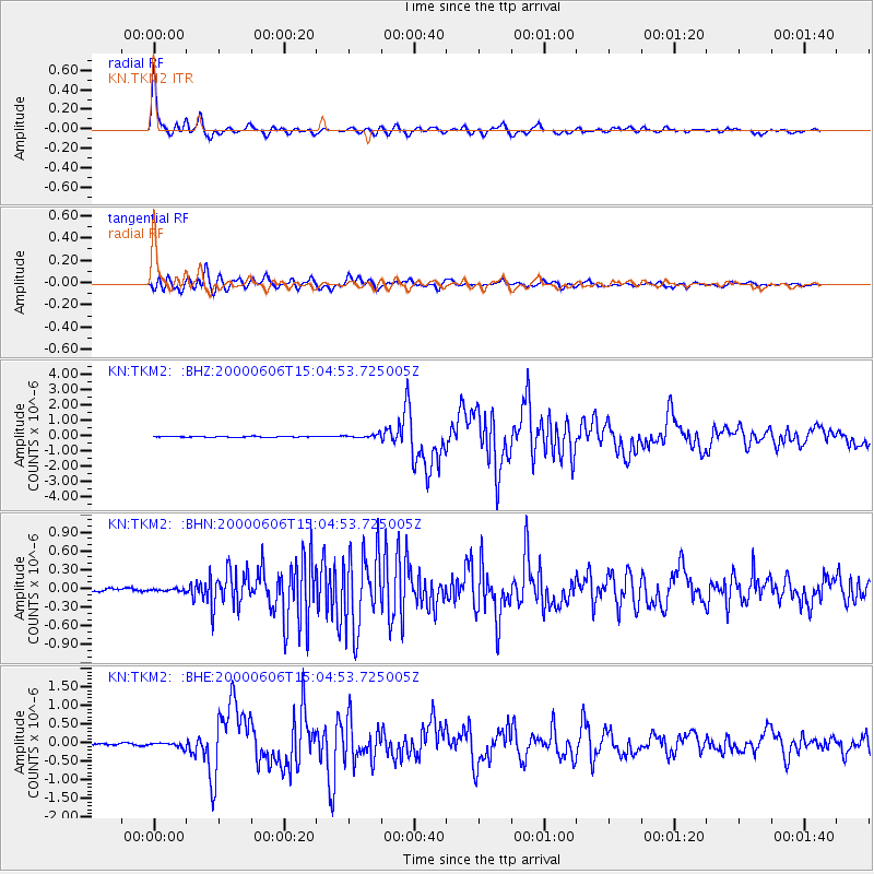
| Channel | StoN | STA | LTA |
| KN:TKM2: :BHN:20000606T15:04:53.725005Z | 0.79332495 | 1.8639534E-8 | 2.3495458E-8 |
| KN:TKM2: :BHE:20000606T15:04:53.725005Z | 3.144691 | 6.510761E-8 | 2.0703977E-8 |
| KN:TKM2: :BHZ:20000606T15:04:53.725005Z | 4.438457 | 1.2196797E-7 | 2.7479816E-8 |
| Arrivals | |
| Ps | 7.2 SECOND |
| PpPs | 22 SECOND |
| PsPs/PpSs | 29 SECOND |

