
TKM2 KN.TKM2 - Earthquake Result Viewer
| ||||||||||||||||||
| ||||||||||||||||||
| ||||||||||||||||||
|
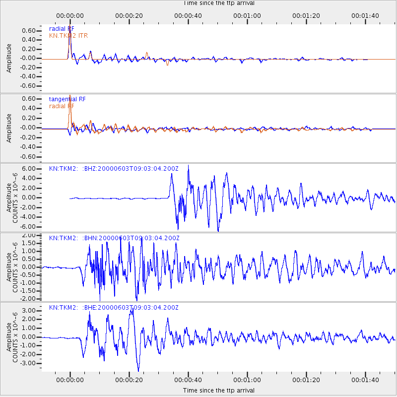
Signal To Noise
| Channel | StoN | STA | LTA |
| KN:TKM2: :BHN:20000603T09:03:04.200Z | 7.5012126 | 3.443271E-7 | 4.590286E-8 |
| KN:TKM2: :BHE:20000603T09:03:04.200Z | 19.441124 | 7.43425E-7 | 3.823982E-8 |
| KN:TKM2: :BHZ:20000603T09:03:04.200Z | 23.609703 | 1.595368E-6 | 6.757256E-8 |
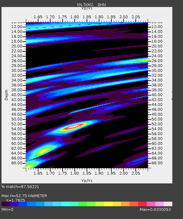
| Arrivals | |
| Ps | 7.0 SECOND |
| PpPs | 22 SECOND |
| PsPs/PpSs | 29 SECOND |

