
TKM2 KN.TKM2 - Earthquake Result Viewer
| ||||||||||||||||||
| ||||||||||||||||||
| ||||||||||||||||||
|
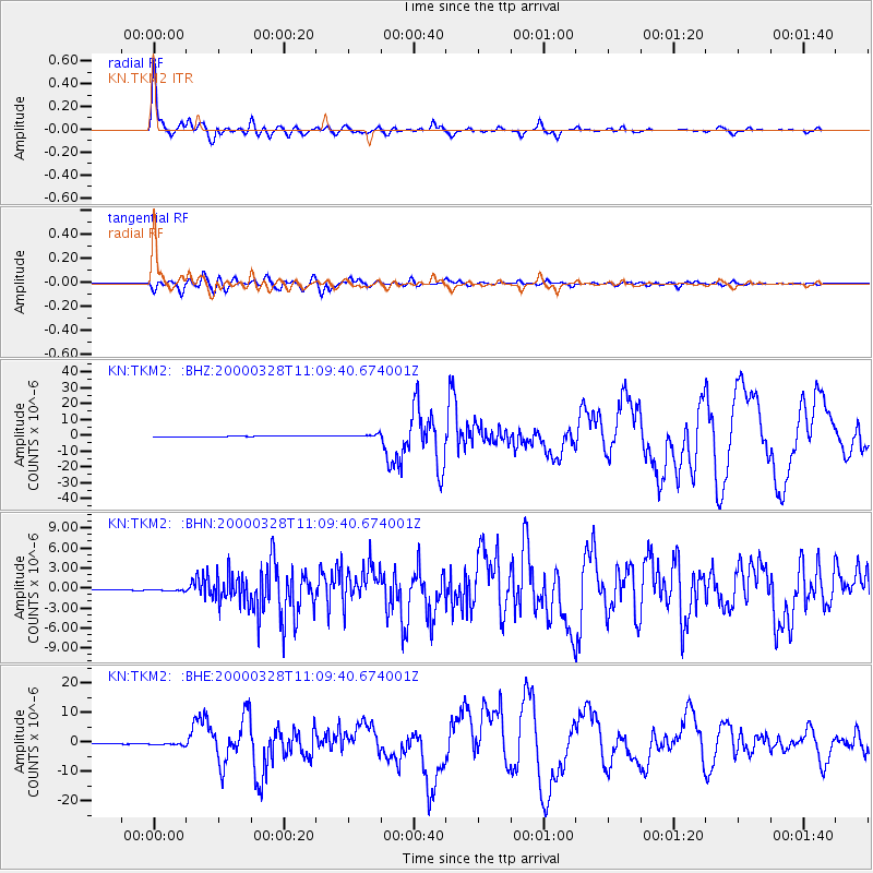
Signal To Noise
| Channel | StoN | STA | LTA |
| KN:TKM2: :BHN:20000328T11:09:40.674001Z | 2.7633662 | 1.8081214E-7 | 6.543184E-8 |
| KN:TKM2: :BHE:20000328T11:09:40.674001Z | 3.028685 | 4.856986E-7 | 1.6036617E-7 |
| KN:TKM2: :BHZ:20000328T11:09:40.674001Z | 4.769521 | 9.1670296E-7 | 1.9220019E-7 |
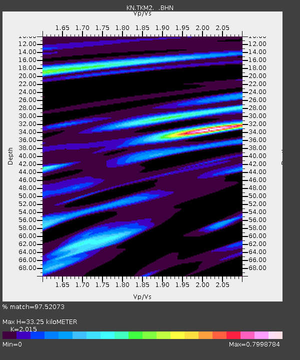
| Arrivals | |
| Ps | 5.6 SECOND |
| PpPs | 15 SECOND |
| PsPs/PpSs | 21 SECOND |

