TKM2 KN.TKM2 - Earthquake Result Viewer
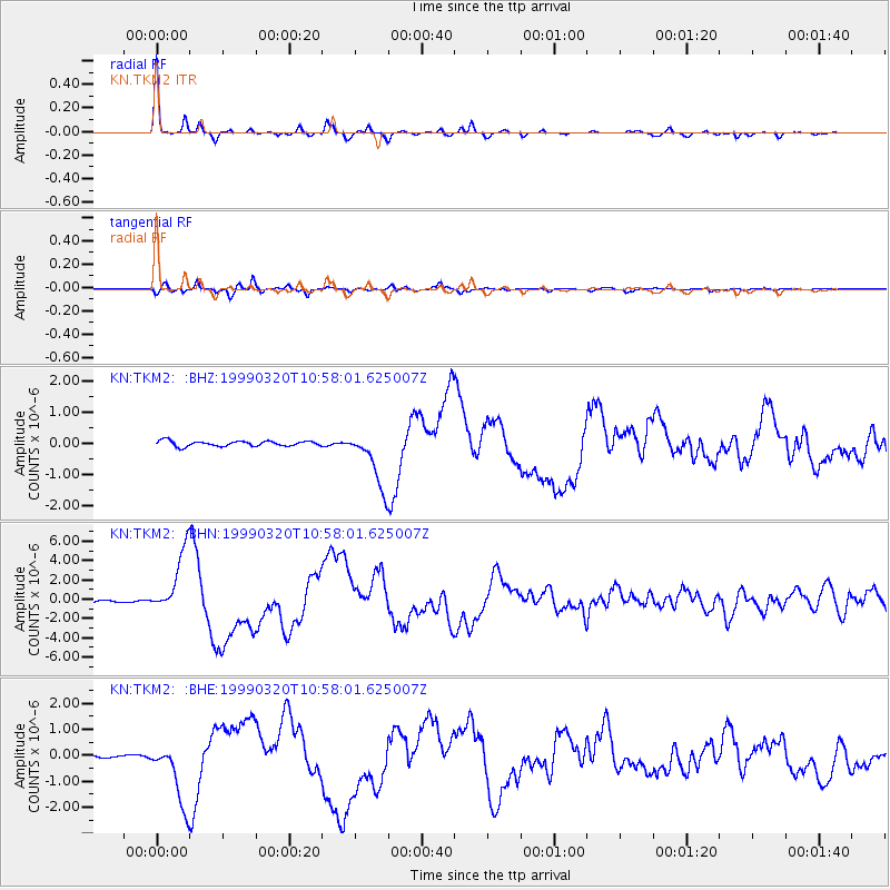
Earthquake location: Andreanof Islands, Aleutian Is.
Earthquake latitude/longitude: 51.6/-177.7
Earthquake time(UTC): 1999/03/20 (079) 10:47:45 GMT
Earthquake Depth: 33 km
Earthquake Magnitude: 6.3 MB, 6.8 MS, 6.9 MW, 6.8 ME
Earthquake Catalog/Contributor: WHDF/NEIC
Network: KN Kyrgyz Seismic Telemetry Network
Station: TKM2 KN.TKM2
Lat/Lon: 42.92 N/75.60 E
Elevation: 2020 m
Distance: 66.5 deg
Az: 309.922 deg
Baz: 40.644 deg
Ray Param: 0.057504762
Estimated Moho Depth: 33.25 km
Estimated Crust Vp/Vs: 1.79
Assumed Crust Vp: 6.306 km/s
Estimated Crust Vs: 3.523 km/s
Estimated Crust Poisson's Ratio: 0.27
Radial Match: 98.07333 %
Radial Bump: 209
Transverse Match: 93.30877 %
Transverse Bump: 400
SOD ConfigId: 4480
Insert Time: 2010-03-08 20:55:48.010 +0000
GWidth: 2.5
Max Bumps: 400
Tol: 0.001

Signal To Noise

ChannelStoNSTALTA
KN:TKM2: :BHN:19990320T10:58:01.625007Z25.979513.2829344E-61.2636629E-7
KN:TKM2: :BHE:19990320T10:58:01.625007Z7.7025041.2528078E-61.6264941E-7
KN:TKM2: :BHZ:19990320T10:58:01.625007Z11.20682059.2980315E-78.296762E-8
Arrivals
Ps4.3 SECOND
PpPs14 SECOND
PsPs/PpSs18 SECOND