
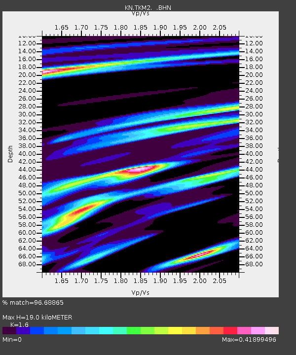
TKM2 KN.TKM2 - Earthquake Result Viewer
| ||||||||||||||||||
| ||||||||||||||||||
| ||||||||||||||||||
|
Signal To Noise
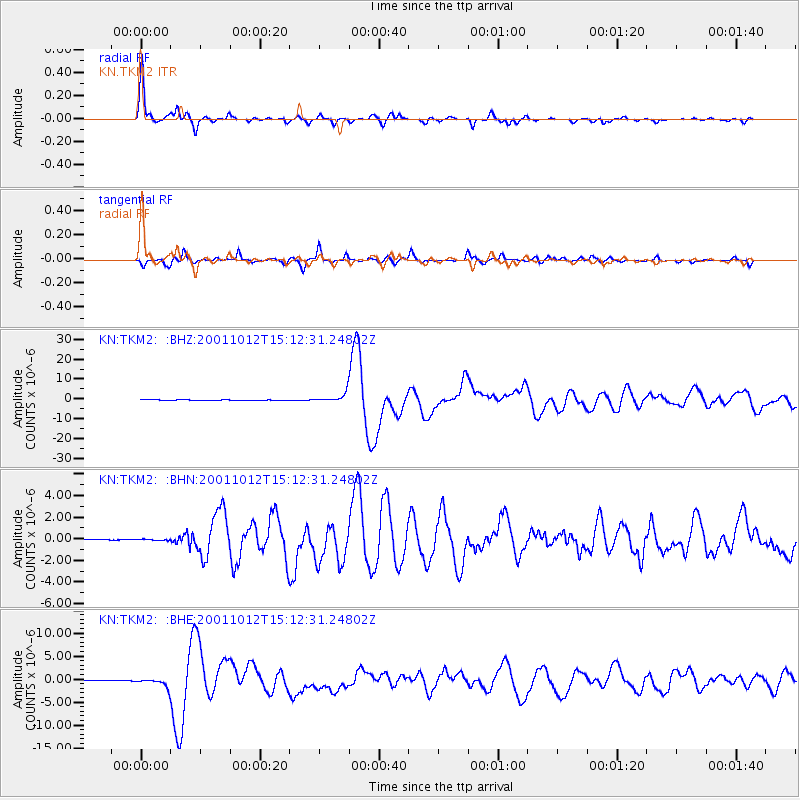
| Channel | StoN | STA | LTA |
| KN:TKM2: :BHN:20011012T15:12:31.24802Z | 1.0556568 | 5.4994562E-8 | 5.209511E-8 |
| KN:TKM2: :BHE:20011012T15:12:31.24802Z | 12.507463 | 8.8862834E-7 | 7.104784E-8 |
| KN:TKM2: :BHZ:20011012T15:12:31.24802Z | 26.464151 | 2.4100063E-6 | 9.106683E-8 |
| Arrivals | |
| Ps | 1.9 SECOND |
| PpPs | 7.5 SECOND |
| PsPs/PpSs | 9.4 SECOND |

