You are here: Home > Network List > TA - USArray Transportable Network (new EarthScope stations) Stations List
> Station F20K Avaraart Lake, AK, USA > Earthquake Result Viewer
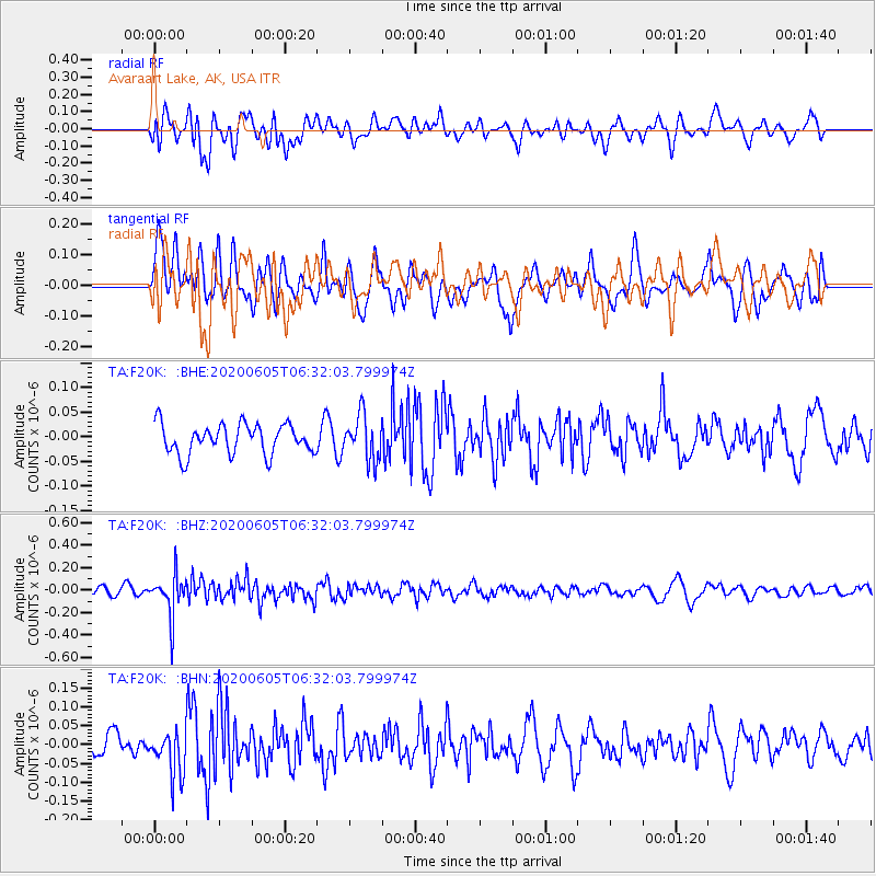
F20K Avaraart Lake, AK, USA - Earthquake Result Viewer
*The percent match for this event was below the threshold and hence no stack was calculated.
| Earthquake location: |
Tonga Islands Region |
| Earthquake latitude/longitude: |
-22.3/-175.5 |
| Earthquake time(UTC): |
2020/06/05 (157) 06:19:38 GMT |
| Earthquake Depth: |
41 km |
| Earthquake Magnitude: |
5.3 Mww |
| Earthquake Catalog/Contributor: |
NEIC PDE/us |
|
| Network: |
TA USArray Transportable Network (new EarthScope stations) |
| Station: |
F20K Avaraart Lake, AK, USA |
| Lat/Lon: |
67.05 N/155.73 W |
| Elevation: |
136 m |
|
| Distance: |
90.3 deg |
| Az: |
7.637 deg |
| Baz: |
198.29 deg |
| Ray Param: |
$rayparam |
*The percent match for this event was below the threshold and hence was not used in the summary stack. |
|
| Radial Match: |
58.918568 % |
| Radial Bump: |
400 |
| Transverse Match: |
55.98492 % |
| Transverse Bump: |
400 |
| SOD ConfigId: |
21166931 |
| Insert Time: |
2020-06-19 06:36:18.099 +0000 |
| GWidth: |
2.5 |
| Max Bumps: |
400 |
| Tol: |
0.001 |
|
Signal To Noise
| Channel | StoN | STA | LTA |
| TA:F20K: :BHZ:20200605T06:32:03.799974Z | 3.8743212 | 1.7797917E-7 | 4.5938155E-8 |
| TA:F20K: :BHN:20200605T06:32:03.799974Z | 2.002748 | 5.921626E-8 | 2.9567504E-8 |
| TA:F20K: :BHE:20200605T06:32:03.799974Z | 1.5127205 | 4.5568587E-8 | 3.0123598E-8 |
| Arrivals |
| Ps | |
| PpPs | |
| PsPs/PpSs | |


