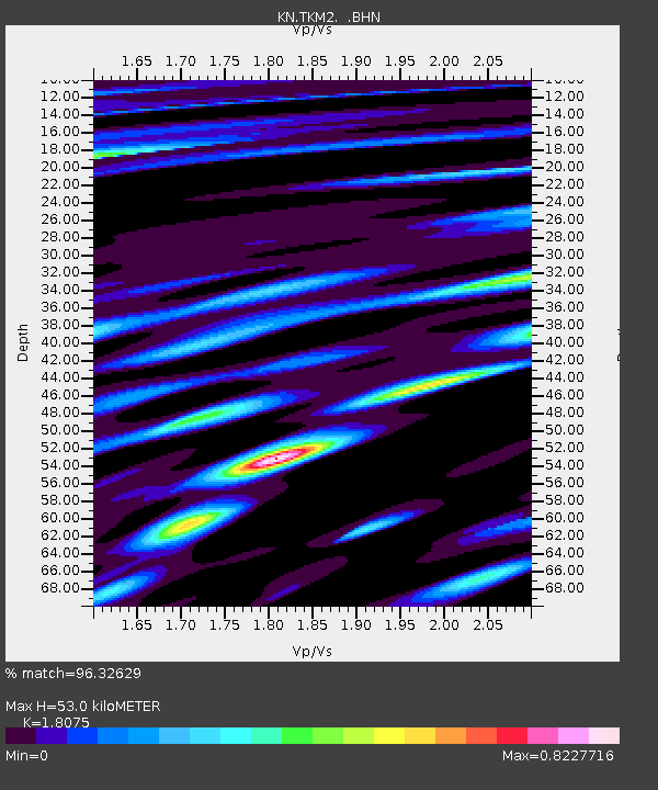
TKM2 KN.TKM2 - Earthquake Result Viewer
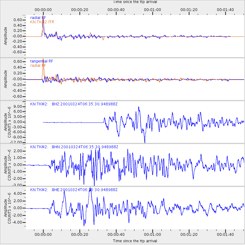
Earthquake location: Western Honshu, Japan
Earthquake latitude/longitude: 34.1/132.5
Earthquake time(UTC): 2001/03/24 (083) 06:27:53 GMT
Earthquake Depth: 50 km
Earthquake Magnitude: 6.4 MB, 6.5 MS, 6.8 MW, 6.4 ME
Earthquake Catalog/Contributor: WHDF/NEIC
Network: KN Kyrgyz Seismic Telemetry Network
Station: TKM2 KN.TKM2
Lat/Lon: 42.92 N/75.60 E
Elevation: 2020 m
Distance: 44.7 deg
Az: 298.882 deg
Baz: 81.62 deg
Ray Param: 0.071644954
Estimated Moho Depth: 53.0 km
Estimated Crust Vp/Vs: 1.81
Assumed Crust Vp: 6.306 km/s
Estimated Crust Vs: 3.489 km/s
Estimated Crust Poisson's Ratio: 0.28
Radial Match: 96.32629 %
Radial Bump: 336
Transverse Match: 89.91846 %
Transverse Bump: 400
SOD ConfigId: 4714
Insert Time: 2010-03-08 20:56:58.140 +0000
GWidth: 2.5
Max Bumps: 400
Tol: 0.001

Signal To Noise

ChannelStoNSTALTA
KN:TKM2: :BHN:20010324T06:35:30.948988Z4.5372942.0360858E-74.4874454E-8
KN:TKM2: :BHE:20010324T06:35:30.948988Z12.390564.3889375E-73.5421625E-8
KN:TKM2: :BHZ:20010324T06:35:30.948988Z12.9331019.512874E-77.3554475E-8
Arrivals
Ps7.2 SECOND
PpPs22 SECOND
PsPs/PpSs29 SECOND