You are here: Home > Network List > US - United States National Seismic Network Stations List
> Station AMTX Amarillo, Texas, USA > Earthquake Result Viewer
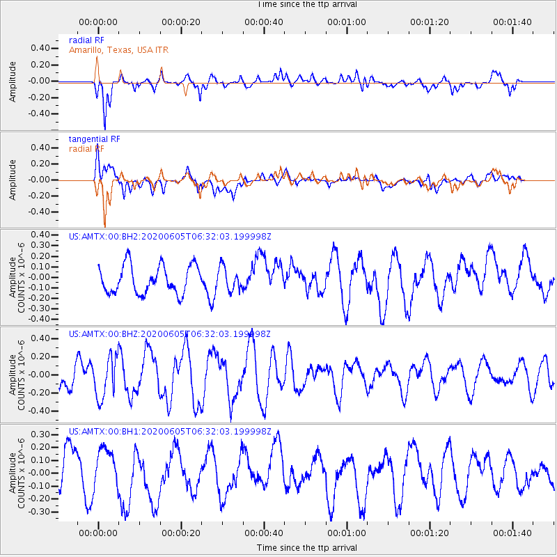
AMTX Amarillo, Texas, USA - Earthquake Result Viewer
*The percent match for this event was below the threshold and hence no stack was calculated.
| Earthquake location: |
Tonga Islands Region |
| Earthquake latitude/longitude: |
-22.3/-175.5 |
| Earthquake time(UTC): |
2020/06/05 (157) 06:19:38 GMT |
| Earthquake Depth: |
41 km |
| Earthquake Magnitude: |
5.3 Mww |
| Earthquake Catalog/Contributor: |
NEIC PDE/us |
|
| Network: |
US United States National Seismic Network |
| Station: |
AMTX Amarillo, Texas, USA |
| Lat/Lon: |
34.53 N/101.41 W |
| Elevation: |
1010 m |
|
| Distance: |
90.2 deg |
| Az: |
52.572 deg |
| Baz: |
242.975 deg |
| Ray Param: |
$rayparam |
*The percent match for this event was below the threshold and hence was not used in the summary stack. |
|
| Radial Match: |
69.67886 % |
| Radial Bump: |
400 |
| Transverse Match: |
66.19692 % |
| Transverse Bump: |
400 |
| SOD ConfigId: |
21166931 |
| Insert Time: |
2020-06-19 06:39:16.816 +0000 |
| GWidth: |
2.5 |
| Max Bumps: |
400 |
| Tol: |
0.001 |
|
Signal To Noise
| Channel | StoN | STA | LTA |
| US:AMTX:00:BHZ:20200605T06:32:03.199998Z | 1.6774155 | 2.3163254E-7 | 1.3808895E-7 |
| US:AMTX:00:BH1:20200605T06:32:03.199998Z | 0.78319913 | 1.4190691E-7 | 1.811888E-7 |
| US:AMTX:00:BH2:20200605T06:32:03.199998Z | 0.8455727 | 1.11491715E-7 | 1.318535E-7 |
| Arrivals |
| Ps | |
| PpPs | |
| PsPs/PpSs | |


