
TKM2 KN.TKM2 - Earthquake Result Viewer
| ||||||||||||||||||
| ||||||||||||||||||
| ||||||||||||||||||
|
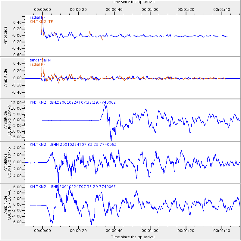
Signal To Noise
| Channel | StoN | STA | LTA |
| KN:TKM2: :BHN:20010224T07:33:29.774006Z | 8.503509 | 8.8569254E-7 | 1.0415613E-7 |
| KN:TKM2: :BHE:20010224T07:33:29.774006Z | 66.63539 | 2.2577346E-6 | 3.3881914E-8 |
| KN:TKM2: :BHZ:20010224T07:33:29.774006Z | 67.593925 | 5.483355E-6 | 8.112201E-8 |
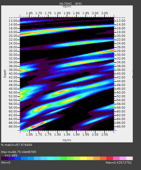
| Arrivals | |
| Ps | 7.7 SECOND |
| PpPs | 27 SECOND |
| PsPs/PpSs | 35 SECOND |

