You are here: Home > Network List > UW - Pacific Northwest Regional Seismic Network Stations List
> Station UMAT Pilot Rock, OR, USA > Earthquake Result Viewer
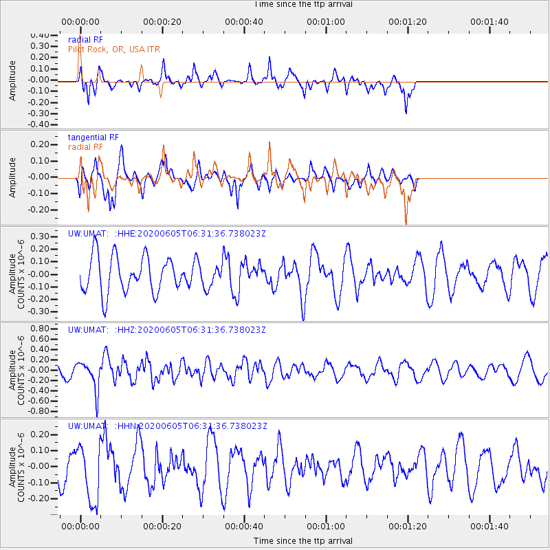
UMAT Pilot Rock, OR, USA - Earthquake Result Viewer
*The percent match for this event was below the threshold and hence no stack was calculated.
| Earthquake location: |
Tonga Islands Region |
| Earthquake latitude/longitude: |
-22.3/-175.5 |
| Earthquake time(UTC): |
2020/06/05 (157) 06:19:38 GMT |
| Earthquake Depth: |
41 km |
| Earthquake Magnitude: |
5.3 Mww |
| Earthquake Catalog/Contributor: |
NEIC PDE/us |
|
| Network: |
UW Pacific Northwest Regional Seismic Network |
| Station: |
UMAT Pilot Rock, OR, USA |
| Lat/Lon: |
45.29 N/118.96 W |
| Elevation: |
1318 m |
|
| Distance: |
84.7 deg |
| Az: |
36.277 deg |
| Baz: |
230.923 deg |
| Ray Param: |
$rayparam |
*The percent match for this event was below the threshold and hence was not used in the summary stack. |
|
| Radial Match: |
72.47935 % |
| Radial Bump: |
355 |
| Transverse Match: |
47.85592 % |
| Transverse Bump: |
294 |
| SOD ConfigId: |
21166931 |
| Insert Time: |
2020-06-19 06:40:36.697 +0000 |
| GWidth: |
2.5 |
| Max Bumps: |
400 |
| Tol: |
0.001 |
|
Signal To Noise
| Channel | StoN | STA | LTA |
| UW:UMAT: :HHZ:20200605T06:31:36.738023Z | 2.8155026 | 2.8694214E-7 | 1.0191507E-7 |
| UW:UMAT: :HHN:20200605T06:31:36.738023Z | 1.5563288 | 1.8134382E-7 | 1.1652025E-7 |
| UW:UMAT: :HHE:20200605T06:31:36.738023Z | 0.5922794 | 8.643434E-8 | 1.4593509E-7 |
| Arrivals |
| Ps | |
| PpPs | |
| PsPs/PpSs | |


