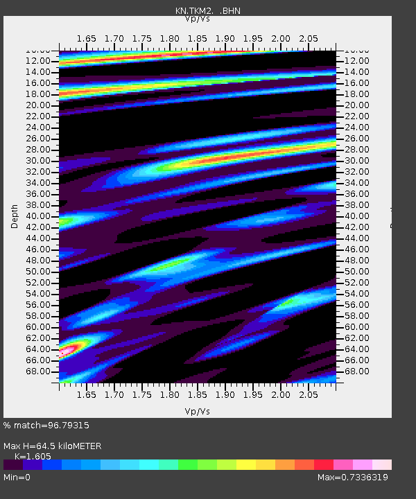
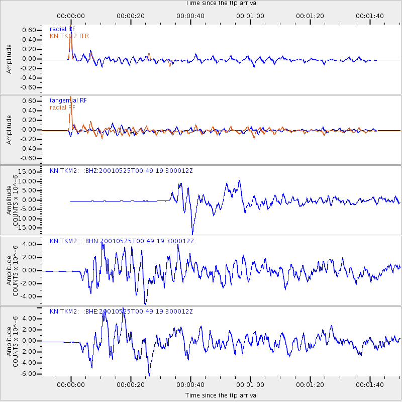
TKM2 KN.TKM2 - Earthquake Result Viewer

Earthquake location: Kuril Islands
Earthquake latitude/longitude: 44.3/148.4
Earthquake time(UTC): 2001/05/25 (145) 00:40:50 GMT
Earthquake Depth: 33 km
Earthquake Magnitude: 6.1 MB, 6.7 MS, 6.7 MW, 6.6 MW
Earthquake Catalog/Contributor: WHDF/NEIC
Network: KN Kyrgyz Seismic Telemetry Network
Station: TKM2 KN.TKM2
Lat/Lon: 42.92 N/75.60 E
Elevation: 2020 m
Distance: 51.1 deg
Az: 295.609 deg
Baz: 61.877 deg
Ray Param: 0.06757069
Estimated Moho Depth: 64.5 km
Estimated Crust Vp/Vs: 1.61
Assumed Crust Vp: 6.306 km/s
Estimated Crust Vs: 3.929 km/s
Estimated Crust Poisson's Ratio: 0.18
Radial Match: 96.79315 %
Radial Bump: 400
Transverse Match: 94.21893 %
Transverse Bump: 400
SOD ConfigId: 4714
Insert Time: 2010-03-08 20:57:30.859 +0000
GWidth: 2.5
Max Bumps: 400
Tol: 0.001

Signal To Noise

ChannelStoNSTALTA
KN:TKM2: :BHN:20010525T00:49:19.300012Z9.0911994.4692146E-74.9159794E-8
KN:TKM2: :BHE:20010525T00:49:19.300012Z19.6740426.20545E-73.1541305E-8
KN:TKM2: :BHZ:20010525T00:49:19.300012Z29.2970831.4544785E-64.9645845E-8
Arrivals
Ps6.6 SECOND
PpPs25 SECOND
PsPs/PpSs32 SECOND