TKM2 KN.TKM2 - Earthquake Result Viewer
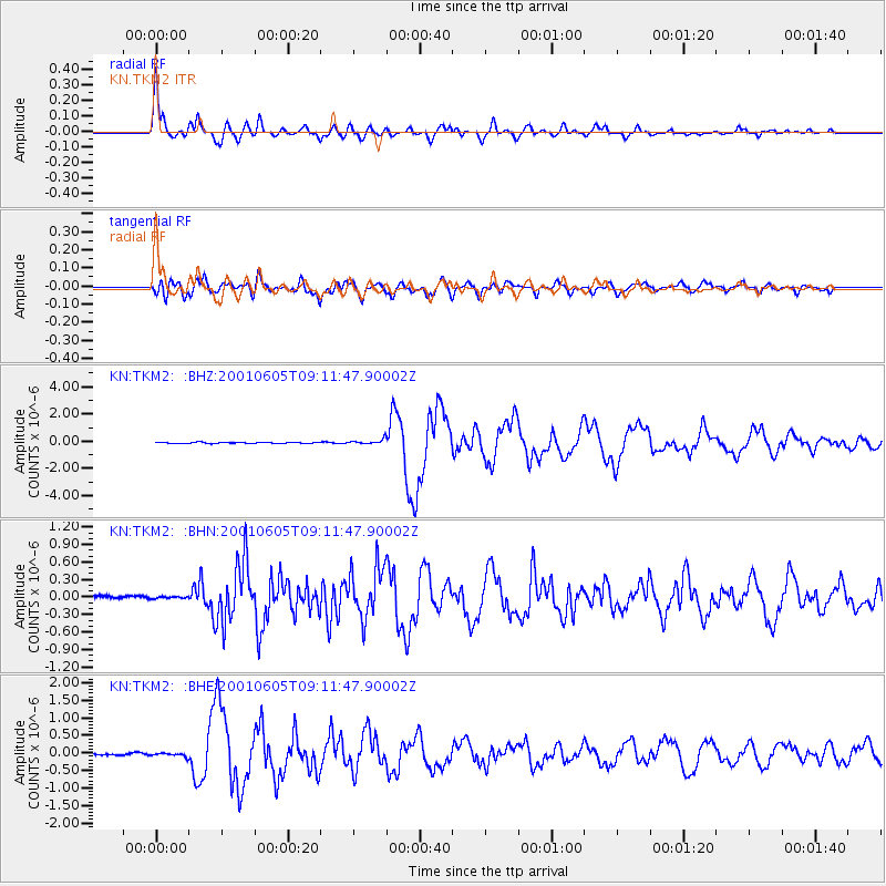
Earthquake location: Eastern New Guinea Reg., P.N.G.
Earthquake latitude/longitude: -6.9/146.4
Earthquake time(UTC): 2001/06/05 (156) 09:00:05 GMT
Earthquake Depth: 10 km
Earthquake Magnitude: 5.8 MB, 6.2 MS, 6.4 MW, 6.1 MW
Earthquake Catalog/Contributor: WHDF/NEIC
Network: KN Kyrgyz Seismic Telemetry Network
Station: TKM2 KN.TKM2
Lat/Lon: 42.92 N/75.60 E
Elevation: 2020 m
Distance: 80.8 deg
Az: 315.361 deg
Baz: 108.247 deg
Ray Param: 0.048003208
Estimated Moho Depth: 34.75 km
Estimated Crust Vp/Vs: 1.91
Assumed Crust Vp: 6.306 km/s
Estimated Crust Vs: 3.293 km/s
Estimated Crust Poisson's Ratio: 0.31
Radial Match: 96.33793 %
Radial Bump: 400
Transverse Match: 86.811 %
Transverse Bump: 400
SOD ConfigId: 4714
Insert Time: 2010-03-08 20:57:36.395 +0000
GWidth: 2.5
Max Bumps: 400
Tol: 0.001

Signal To Noise

ChannelStoNSTALTA
KN:TKM2: :BHN:20010605T09:11:47.90002Z0.753197852.3683128E-83.1443435E-8
KN:TKM2: :BHE:20010605T09:11:47.90002Z1.54367054.7426315E-83.072308E-8
KN:TKM2: :BHZ:20010605T09:11:47.90002Z3.84777831.7727821E-74.6072874E-8
Arrivals
Ps5.2 SECOND
PpPs16 SECOND
PsPs/PpSs21 SECOND