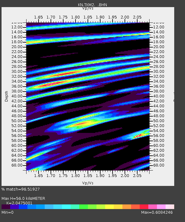
TKM2 KN.TKM2 - Earthquake Result Viewer
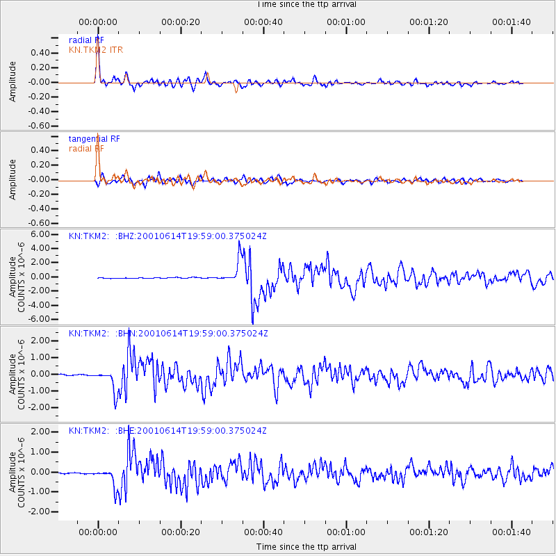
Earthquake location: Andreanof Islands, Aleutian Is.
Earthquake latitude/longitude: 51.2/-179.8
Earthquake time(UTC): 2001/06/14 (165) 19:48:47 GMT
Earthquake Depth: 18 km
Earthquake Magnitude: 6.0 MB, 6.3 MS, 6.5 MW, 6.1 ML
Earthquake Catalog/Contributor: WHDF/NEIC
Network: KN Kyrgyz Seismic Telemetry Network
Station: TKM2 KN.TKM2
Lat/Lon: 42.92 N/75.60 E
Elevation: 2020 m
Distance: 65.8 deg
Az: 308.764 deg
Baz: 41.945 deg
Ray Param: 0.05804931
Estimated Moho Depth: 56.0 km
Estimated Crust Vp/Vs: 2.05
Assumed Crust Vp: 6.306 km/s
Estimated Crust Vs: 3.08 km/s
Estimated Crust Poisson's Ratio: 0.34
Radial Match: 96.51927 %
Radial Bump: 400
Transverse Match: 90.23859 %
Transverse Bump: 400
SOD ConfigId: 4714
Insert Time: 2010-03-08 20:57:39.345 +0000
GWidth: 2.5
Max Bumps: 400
Tol: 0.001

Signal To Noise

ChannelStoNSTALTA
KN:TKM2: :BHN:20010614T19:59:00.375024Z28.2422567.0345E-72.4907711E-8
KN:TKM2: :BHE:20010614T19:59:00.375024Z24.511414.852019E-71.979494E-8
KN:TKM2: :BHZ:20010614T19:59:00.375024Z33.8183331.7444145E-65.158192E-8
Arrivals
Ps9.6 SECOND
PpPs26 SECOND
PsPs/PpSs36 SECOND