
TKM2 KN.TKM2 - Earthquake Result Viewer
| ||||||||||||||||||
| ||||||||||||||||||
| ||||||||||||||||||
|
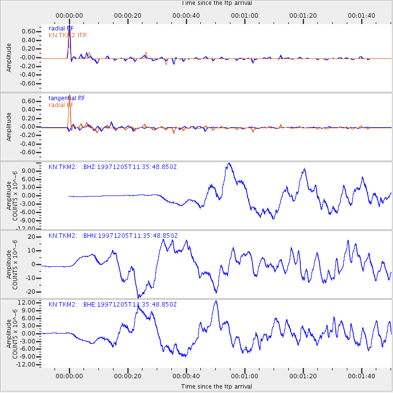
Signal To Noise
| Channel | StoN | STA | LTA |
| KN:TKM2: :BHN:19971205T11:35:48.850Z | 10.052749 | 3.6513525E-6 | 3.6321933E-7 |
| KN:TKM2: :BHE:19971205T11:35:48.850Z | 4.878914 | 1.3150733E-6 | 2.6954223E-7 |
| KN:TKM2: :BHZ:19971205T11:35:48.850Z | 7.177504 | 1.272927E-6 | 1.7734953E-7 |
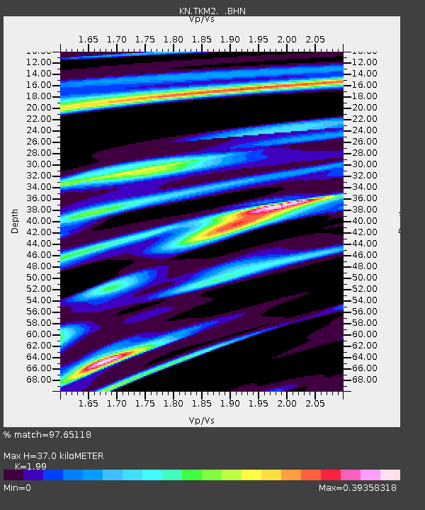
| Arrivals | |
| Ps | 6.1 SECOND |
| PpPs | 17 SECOND |
| PsPs/PpSs | 23 SECOND |

