
TKM2 KN.TKM2 - Earthquake Result Viewer
| ||||||||||||||||||
| ||||||||||||||||||
| ||||||||||||||||||
|
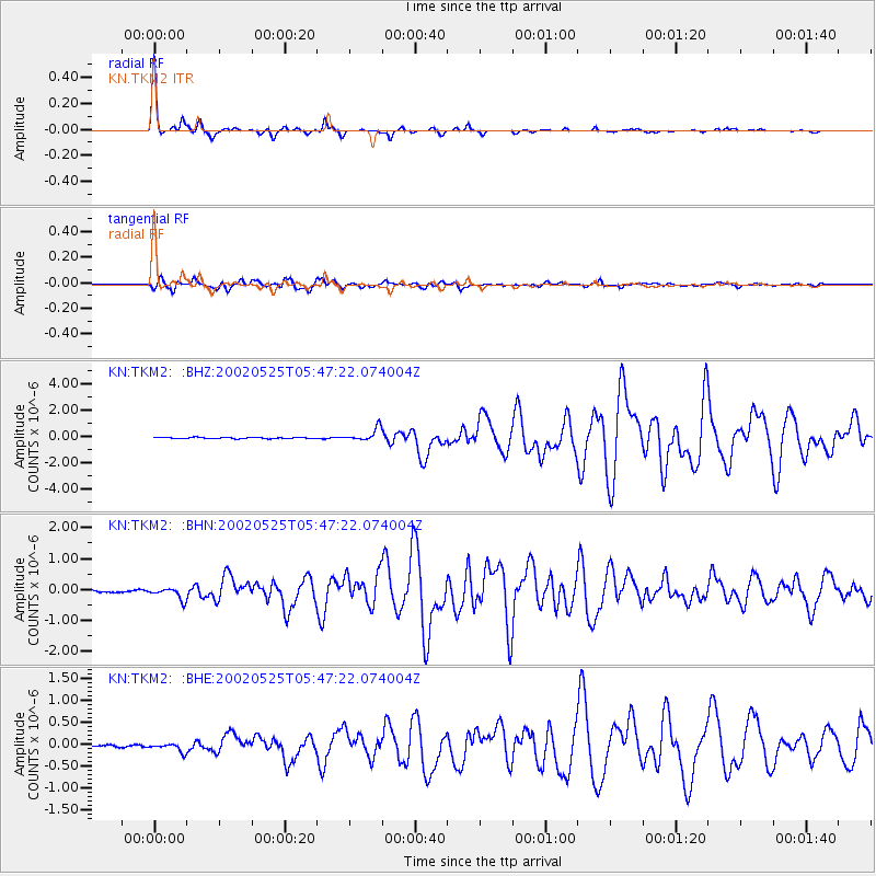
Signal To Noise
| Channel | StoN | STA | LTA |
| KN:TKM2: :BHN:20020525T05:47:22.074004Z | 4.083507 | 1.9686279E-7 | 4.8209245E-8 |
| KN:TKM2: :BHE:20020525T05:47:22.074004Z | 4.0909486 | 9.979344E-8 | 2.4393717E-8 |
| KN:TKM2: :BHZ:20020525T05:47:22.074004Z | 10.438318 | 4.8289917E-7 | 4.6262162E-8 |
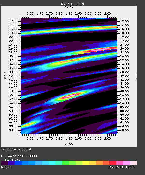
| Arrivals | |
| Ps | 7.0 SECOND |
| PpPs | 22 SECOND |
| PsPs/PpSs | 29 SECOND |

