TKM2 KN.TKM2 - Earthquake Result Viewer
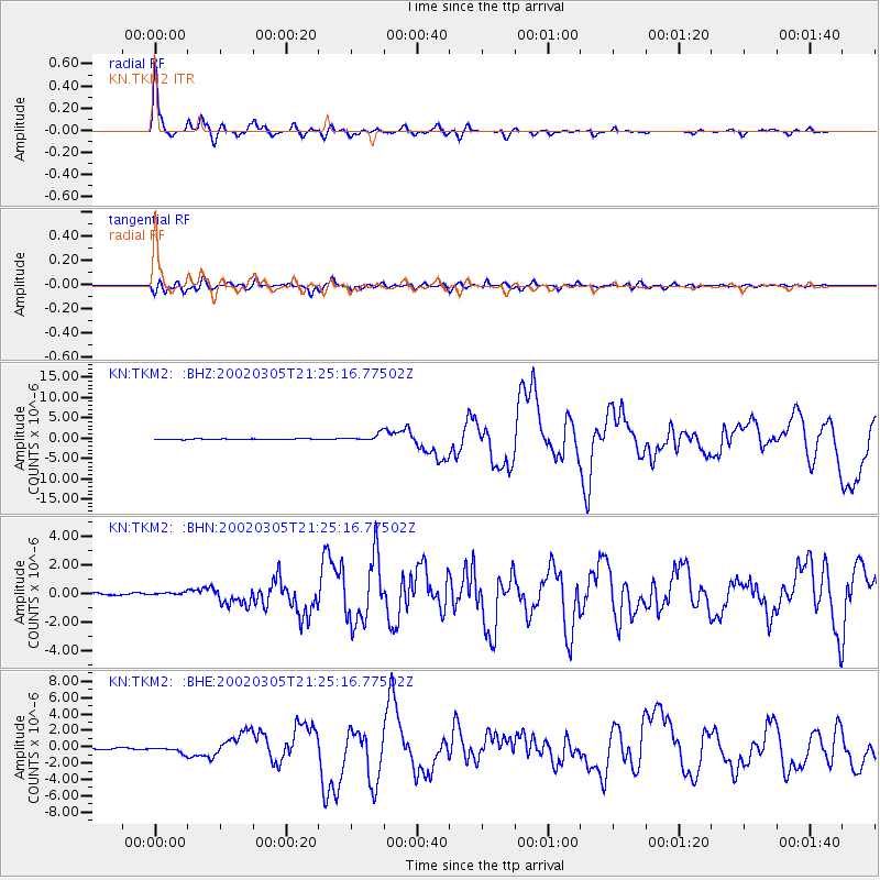
Earthquake location: Mindanao, Philippines
Earthquake latitude/longitude: 6.0/124.2
Earthquake time(UTC): 2002/03/05 (064) 21:16:09 GMT
Earthquake Depth: 31 km
Earthquake Magnitude: 6.3 MB, 7.2 MS, 7.5 MW, 7.2 MW
Earthquake Catalog/Contributor: WHDF/NEIC
Network: KN Kyrgyz Seismic Telemetry Network
Station: TKM2 KN.TKM2
Lat/Lon: 42.92 N/75.60 E
Elevation: 2020 m
Distance: 56.4 deg
Az: 318.539 deg
Baz: 116.307 deg
Ray Param: 0.06411674
Estimated Moho Depth: 57.75 km
Estimated Crust Vp/Vs: 1.74
Assumed Crust Vp: 6.306 km/s
Estimated Crust Vs: 3.619 km/s
Estimated Crust Poisson's Ratio: 0.25
Radial Match: 96.483604 %
Radial Bump: 348
Transverse Match: 89.59031 %
Transverse Bump: 400
SOD ConfigId: 20082
Insert Time: 2010-03-08 20:59:04.533 +0000
GWidth: 2.5
Max Bumps: 400
Tol: 0.001

Signal To Noise

ChannelStoNSTALTA
KN:TKM2: :BHN:20020305T21:25:16.77502Z1.25886381.228195E-79.756377E-8
KN:TKM2: :BHE:20020305T21:25:16.77502Z2.72603653.686997E-71.352512E-7
KN:TKM2: :BHZ:20020305T21:25:16.77502Z10.568559.038892E-78.552632E-8
Arrivals
Ps7.1 SECOND
PpPs24 SECOND
PsPs/PpSs31 SECOND