
TKM2 KN.TKM2 - Earthquake Result Viewer
| ||||||||||||||||||
| ||||||||||||||||||
| ||||||||||||||||||
|
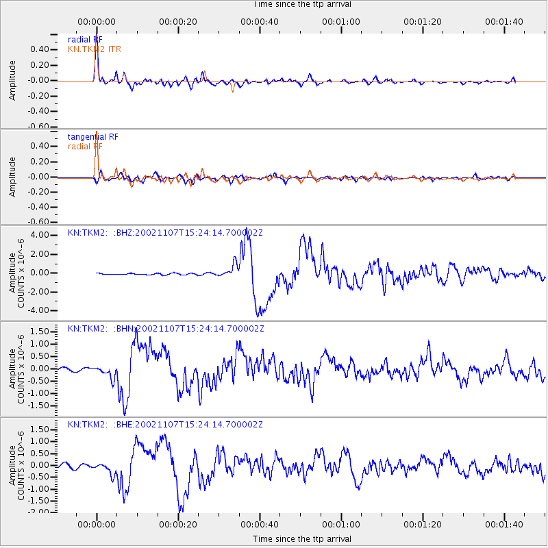
Signal To Noise
| Channel | StoN | STA | LTA |
| KN:TKM2: :BHN:20021107T15:24:14.700002Z | 3.5422952 | 2.7007601E-7 | 7.6243225E-8 |
| KN:TKM2: :BHE:20021107T15:24:14.700002Z | 3.2940156 | 2.66562E-7 | 8.092311E-8 |
| KN:TKM2: :BHZ:20021107T15:24:14.700002Z | 9.809037 | 7.174299E-7 | 7.313969E-8 |
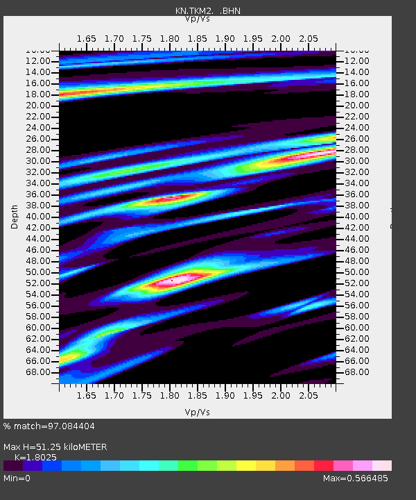
| Arrivals | |
| Ps | 6.8 SECOND |
| PpPs | 22 SECOND |
| PsPs/PpSs | 29 SECOND |

