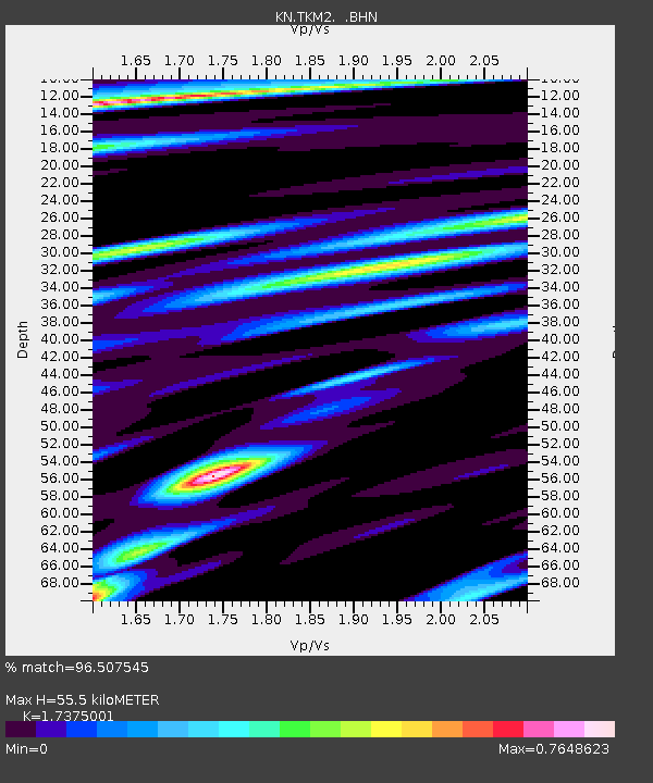
TKM2 KN.TKM2 - Earthquake Result Viewer
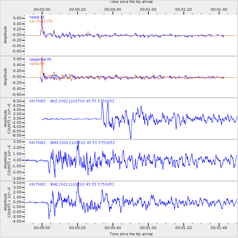
Earthquake location: Near East Coast Of Honshu, Japan
Earthquake latitude/longitude: 38.9/142.0
Earthquake time(UTC): 2002/11/03 (307) 03:37:42 GMT
Earthquake Depth: 39 km
Earthquake Magnitude: 5.7 MB, 6.1 MS, 6.4 MW, 6.4 MW
Earthquake Catalog/Contributor: WHDF/NEIC
Network: KN Kyrgyz Seismic Telemetry Network
Station: TKM2 KN.TKM2
Lat/Lon: 42.92 N/75.60 E
Elevation: 2020 m
Distance: 49.2 deg
Az: 297.177 deg
Baz: 70.937 deg
Ray Param: 0.06879238
Estimated Moho Depth: 55.5 km
Estimated Crust Vp/Vs: 1.74
Assumed Crust Vp: 6.306 km/s
Estimated Crust Vs: 3.629 km/s
Estimated Crust Poisson's Ratio: 0.25
Radial Match: 96.507545 %
Radial Bump: 400
Transverse Match: 87.900475 %
Transverse Bump: 400
SOD ConfigId: 4714
Insert Time: 2010-03-08 20:59:17.333 +0000
GWidth: 2.5
Max Bumps: 400
Tol: 0.001

Signal To Noise

ChannelStoNSTALTA
KN:TKM2: :BHN:20021103T03:45:55.575005Z4.2442786.4670564E-71.5237119E-7
KN:TKM2: :BHE:20021103T03:45:55.575005Z14.3083121.0879176E-67.6033956E-8
KN:TKM2: :BHZ:20021103T03:45:55.575005Z19.5471652.4622625E-61.259652E-7
Arrivals
Ps6.9 SECOND
PpPs23 SECOND
PsPs/PpSs30 SECOND