
TKM2 KN.TKM2 - Earthquake Result Viewer
| ||||||||||||||||||
| ||||||||||||||||||
| ||||||||||||||||||
|
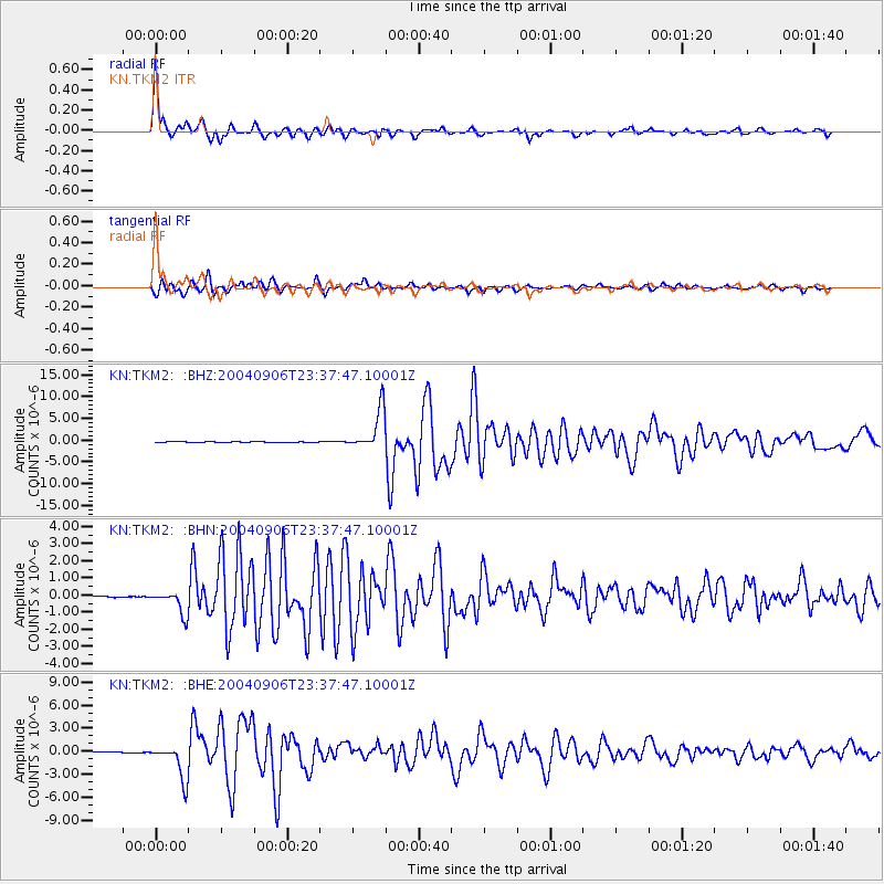
Signal To Noise
| Channel | StoN | STA | LTA |
| KN:TKM2: :BHN:20040906T23:37:47.10001Z | 12.290757 | 6.9181806E-7 | 5.6287668E-8 |
| KN:TKM2: :BHE:20040906T23:37:47.10001Z | 55.0403 | 2.2686252E-6 | 4.1217532E-8 |
| KN:TKM2: :BHZ:20040906T23:37:47.10001Z | 91.341415 | 4.655115E-6 | 5.0963905E-8 |
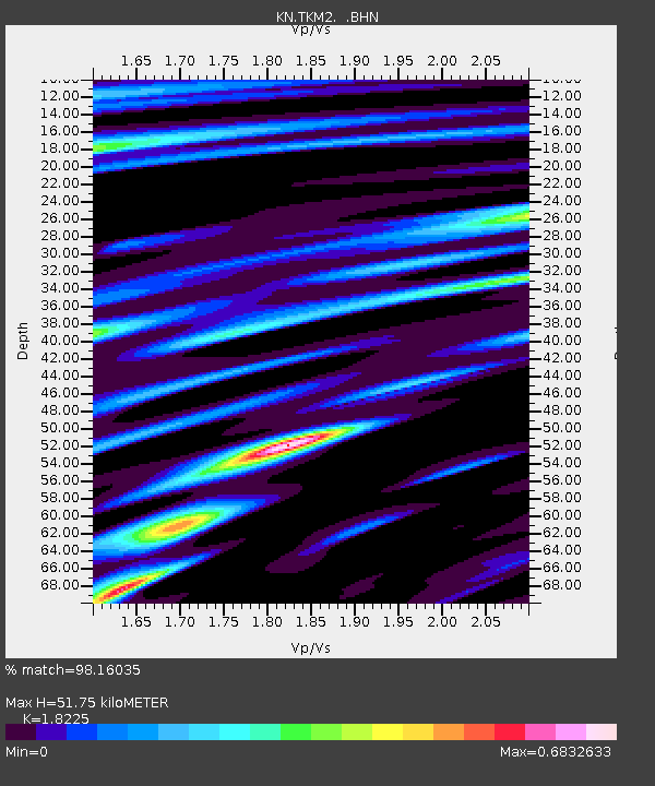
| Arrivals | |
| Ps | 7.1 SECOND |
| PpPs | 22 SECOND |
| PsPs/PpSs | 29 SECOND |

