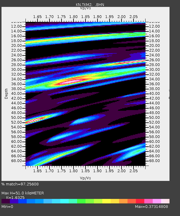
TKM2 KN.TKM2 - Earthquake Result Viewer
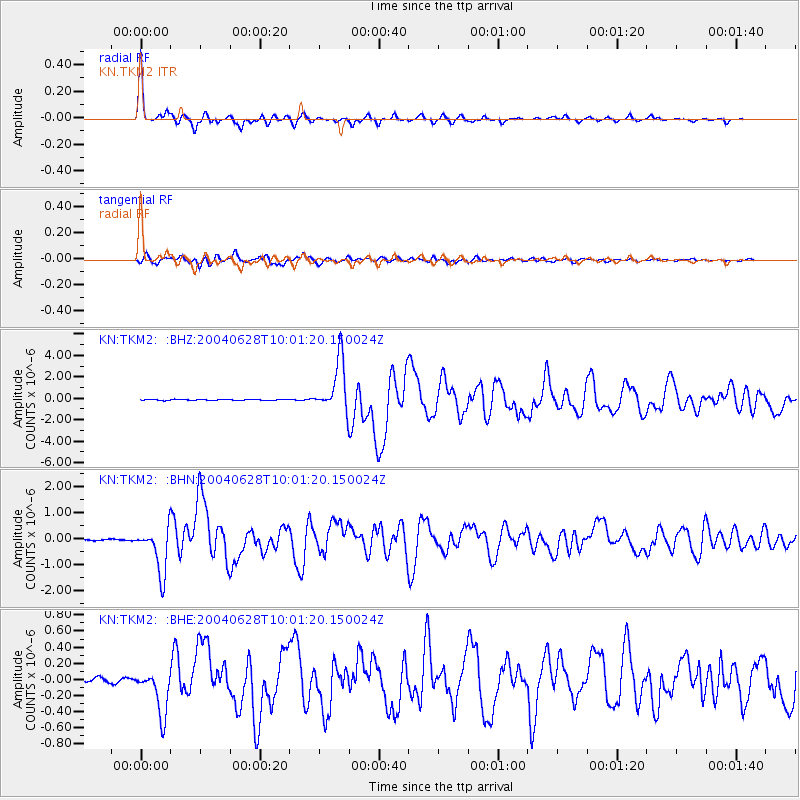
Earthquake location: Queen Charlotte Islands Region
Earthquake latitude/longitude: 54.8/-134.2
Earthquake time(UTC): 2004/06/28 (180) 09:49:47 GMT
Earthquake Depth: 20 km
Earthquake Magnitude: 5.9 MB, 6.8 MS, 6.8 MW, 6.8 MW
Earthquake Catalog/Contributor: WHDF/NEIC
Network: KN Kyrgyz Seismic Telemetry Network
Station: TKM2 KN.TKM2
Lat/Lon: 42.92 N/75.60 E
Elevation: 2020 m
Distance: 79.4 deg
Az: 338.164 deg
Baz: 17.049 deg
Ray Param: 0.0489825
Estimated Moho Depth: 51.0 km
Estimated Crust Vp/Vs: 1.63
Assumed Crust Vp: 6.306 km/s
Estimated Crust Vs: 3.863 km/s
Estimated Crust Poisson's Ratio: 0.20
Radial Match: 97.25608 %
Radial Bump: 342
Transverse Match: 93.67062 %
Transverse Bump: 400
SOD ConfigId: 2459
Insert Time: 2010-03-08 21:01:17.336 +0000
GWidth: 2.5
Max Bumps: 400
Tol: 0.001

Signal To Noise

ChannelStoNSTALTA
KN:TKM2: :BHN:20040628T10:01:20.150024Z23.9782859.076874E-73.7854562E-8
KN:TKM2: :BHE:20040628T10:01:20.150024Z10.366862.8751052E-72.7733618E-8
KN:TKM2: :BHZ:20040628T10:01:20.150024Z54.49832.436054E-64.4699632E-8
Arrivals
Ps5.3 SECOND
PpPs21 SECOND
PsPs/PpSs26 SECOND