
TKM2 KN.TKM2 - Earthquake Result Viewer
| ||||||||||||||||||
| ||||||||||||||||||
| ||||||||||||||||||
|
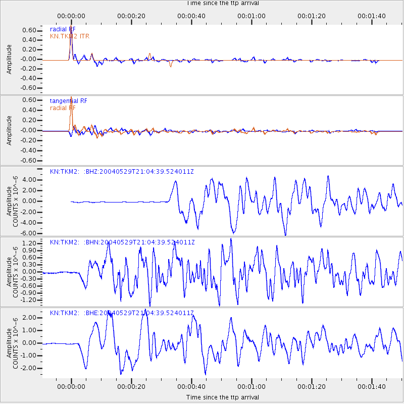
Signal To Noise
| Channel | StoN | STA | LTA |
| KN:TKM2: :BHN:20040529T21:04:39.524011Z | 8.201471 | 2.380767E-7 | 2.9028536E-8 |
| KN:TKM2: :BHE:20040529T21:04:39.524011Z | 14.965593 | 7.257113E-7 | 4.8491984E-8 |
| KN:TKM2: :BHZ:20040529T21:04:39.524011Z | 33.875164 | 1.5883523E-6 | 4.6888406E-8 |
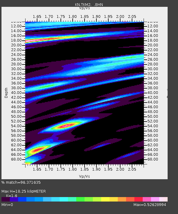
| Arrivals | |
| Ps | 1.8 SECOND |
| PpPs | 7.1 SECOND |
| PsPs/PpSs | 8.9 SECOND |

