You are here: Home > Network List > TA - USArray Transportable Network (new EarthScope stations) Stations List
> Station C16K Lisburne Hills, AK, USA > Earthquake Result Viewer
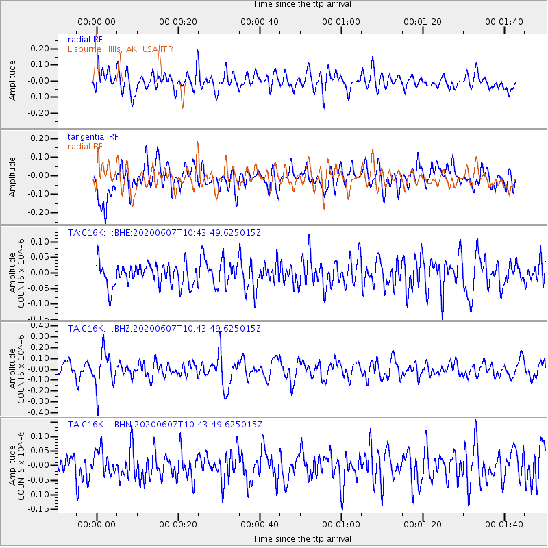
C16K Lisburne Hills, AK, USA - Earthquake Result Viewer
*The percent match for this event was below the threshold and hence no stack was calculated.
| Earthquake location: |
Northern Peru |
| Earthquake latitude/longitude: |
-4.0/-76.9 |
| Earthquake time(UTC): |
2020/06/07 (159) 10:31:17 GMT |
| Earthquake Depth: |
99 km |
| Earthquake Magnitude: |
5.4 Mww |
| Earthquake Catalog/Contributor: |
NEIC PDE/us |
|
| Network: |
TA USArray Transportable Network (new EarthScope stations) |
| Station: |
C16K Lisburne Hills, AK, USA |
| Lat/Lon: |
68.27 N/165.34 W |
| Elevation: |
102 m |
|
| Distance: |
93.1 deg |
| Az: |
338.117 deg |
| Baz: |
92.979 deg |
| Ray Param: |
$rayparam |
*The percent match for this event was below the threshold and hence was not used in the summary stack. |
|
| Radial Match: |
56.89335 % |
| Radial Bump: |
400 |
| Transverse Match: |
66.847275 % |
| Transverse Bump: |
400 |
| SOD ConfigId: |
21166931 |
| Insert Time: |
2020-06-21 10:55:57.231 +0000 |
| GWidth: |
2.5 |
| Max Bumps: |
400 |
| Tol: |
0.001 |
|
Signal To Noise
| Channel | StoN | STA | LTA |
| TA:C16K: :BHZ:20200607T10:43:49.625015Z | 3.273578 | 1.738976E-7 | 5.312157E-8 |
| TA:C16K: :BHN:20200607T10:43:49.625015Z | 1.0044062 | 4.2958696E-8 | 4.2770242E-8 |
| TA:C16K: :BHE:20200607T10:43:49.625015Z | 1.1742536 | 4.03581E-8 | 3.4369155E-8 |
| Arrivals |
| Ps | |
| PpPs | |
| PsPs/PpSs | |


