You are here: Home > Network List > TA - USArray Transportable Network (new EarthScope stations) Stations List
> Station H16K Elim, AK, USA > Earthquake Result Viewer
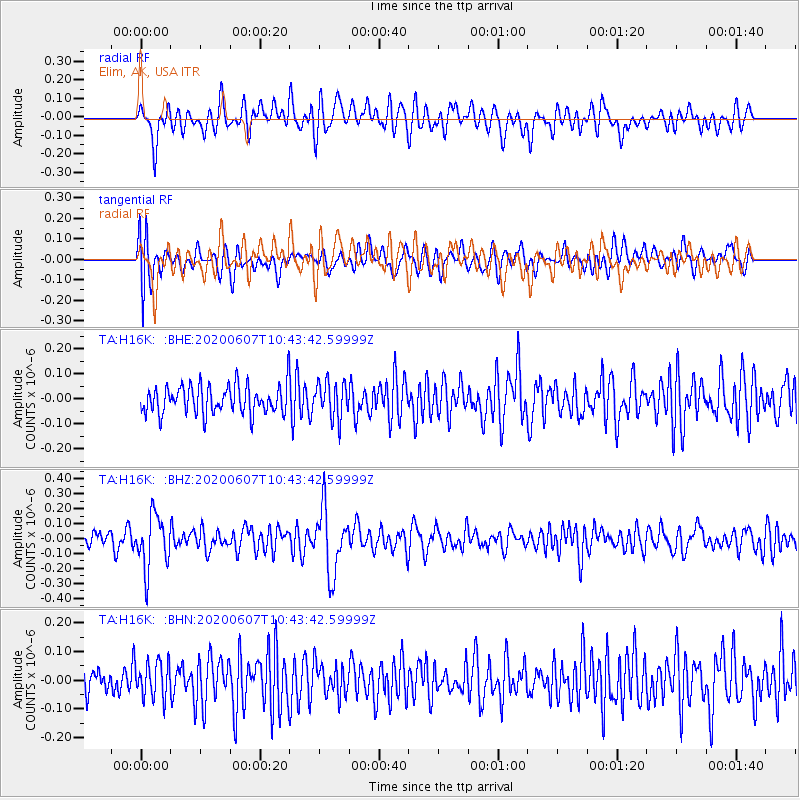
H16K Elim, AK, USA - Earthquake Result Viewer
*The percent match for this event was below the threshold and hence no stack was calculated.
| Earthquake location: |
Northern Peru |
| Earthquake latitude/longitude: |
-4.0/-76.9 |
| Earthquake time(UTC): |
2020/06/07 (159) 10:31:17 GMT |
| Earthquake Depth: |
99 km |
| Earthquake Magnitude: |
5.4 Mww |
| Earthquake Catalog/Contributor: |
NEIC PDE/us |
|
| Network: |
TA USArray Transportable Network (new EarthScope stations) |
| Station: |
H16K Elim, AK, USA |
| Lat/Lon: |
64.64 N/162.24 W |
| Elevation: |
216 m |
|
| Distance: |
91.6 deg |
| Az: |
334.57 deg |
| Baz: |
95.97 deg |
| Ray Param: |
$rayparam |
*The percent match for this event was below the threshold and hence was not used in the summary stack. |
|
| Radial Match: |
66.16021 % |
| Radial Bump: |
400 |
| Transverse Match: |
58.006676 % |
| Transverse Bump: |
400 |
| SOD ConfigId: |
21166931 |
| Insert Time: |
2020-06-21 10:57:15.700 +0000 |
| GWidth: |
2.5 |
| Max Bumps: |
400 |
| Tol: |
0.001 |
|
Signal To Noise
| Channel | StoN | STA | LTA |
| TA:H16K: :BHZ:20200607T10:43:42.59999Z | 2.7300117 | 1.7848238E-7 | 6.537788E-8 |
| TA:H16K: :BHN:20200607T10:43:42.59999Z | 1.2583126 | 6.2777694E-8 | 4.989038E-8 |
| TA:H16K: :BHE:20200607T10:43:42.59999Z | 1.2879235 | 7.2621E-8 | 5.6386114E-8 |
| Arrivals |
| Ps | |
| PpPs | |
| PsPs/PpSs | |


