You are here: Home > Network List > TA - USArray Transportable Network (new EarthScope stations) Stations List
> Station I30M Mount Dempster, Yukon, CAN > Earthquake Result Viewer
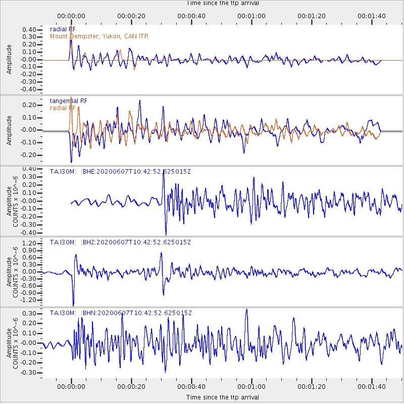
I30M Mount Dempster, Yukon, CAN - Earthquake Result Viewer
*The percent match for this event was below the threshold and hence no stack was calculated.
| Earthquake location: |
Northern Peru |
| Earthquake latitude/longitude: |
-4.0/-76.9 |
| Earthquake time(UTC): |
2020/06/07 (159) 10:31:17 GMT |
| Earthquake Depth: |
99 km |
| Earthquake Magnitude: |
5.4 Mww |
| Earthquake Catalog/Contributor: |
NEIC PDE/us |
|
| Network: |
TA USArray Transportable Network (new EarthScope stations) |
| Station: |
I30M Mount Dempster, Yukon, CAN |
| Lat/Lon: |
65.22 N/136.38 W |
| Elevation: |
1399 m |
|
| Distance: |
81.4 deg |
| Az: |
338.467 deg |
| Baz: |
119.68 deg |
| Ray Param: |
$rayparam |
*The percent match for this event was below the threshold and hence was not used in the summary stack. |
|
| Radial Match: |
77.2023 % |
| Radial Bump: |
400 |
| Transverse Match: |
75.56463 % |
| Transverse Bump: |
400 |
| SOD ConfigId: |
21166931 |
| Insert Time: |
2020-06-21 10:57:32.660 +0000 |
| GWidth: |
2.5 |
| Max Bumps: |
400 |
| Tol: |
0.001 |
|
Signal To Noise
| Channel | StoN | STA | LTA |
| TA:I30M: :BHZ:20200607T10:42:52.625015Z | 9.660071 | 4.438039E-7 | 4.5942095E-8 |
| TA:I30M: :BHN:20200607T10:42:52.625015Z | 4.02348 | 1.2767524E-7 | 3.173254E-8 |
| TA:I30M: :BHE:20200607T10:42:52.625015Z | 5.285065 | 1.7166727E-7 | 3.248158E-8 |
| Arrivals |
| Ps | |
| PpPs | |
| PsPs/PpSs | |


