
TKM2 KN.TKM2 - Earthquake Result Viewer
| ||||||||||||||||||
| ||||||||||||||||||
| ||||||||||||||||||
|
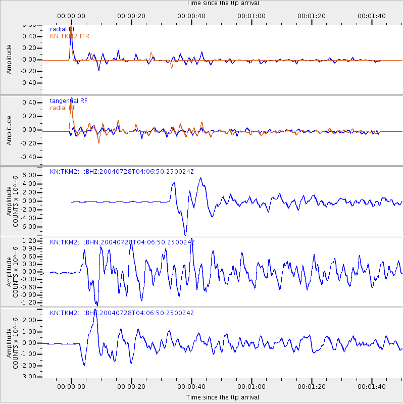
Signal To Noise
| Channel | StoN | STA | LTA |
| KN:TKM2: :BHN:20040728T04:06:50.250024Z | 14.3467865 | 3.0609482E-7 | 2.1335426E-8 |
| KN:TKM2: :BHE:20040728T04:06:50.250024Z | 30.92251 | 7.901113E-7 | 2.5551332E-8 |
| KN:TKM2: :BHZ:20040728T04:06:50.250024Z | 35.839542 | 1.9811228E-6 | 5.5277567E-8 |
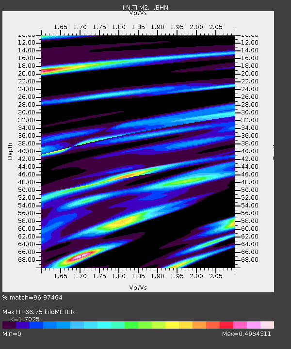
| Arrivals | |
| Ps | 7.7 SECOND |
| PpPs | 27 SECOND |
| PsPs/PpSs | 35 SECOND |

