You are here: Home > Network List > TA - USArray Transportable Network (new EarthScope stations) Stations List
> Station M31M Drury Creek, Yukon, CA > Earthquake Result Viewer
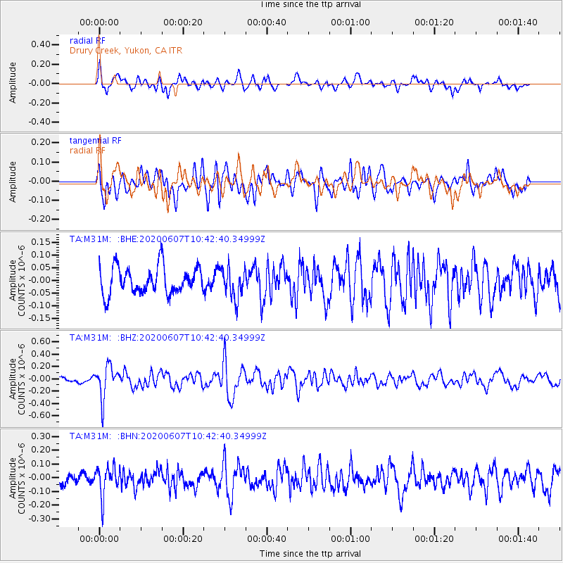
M31M Drury Creek, Yukon, CA - Earthquake Result Viewer
*The percent match for this event was below the threshold and hence no stack was calculated.
| Earthquake location: |
Northern Peru |
| Earthquake latitude/longitude: |
-4.0/-76.9 |
| Earthquake time(UTC): |
2020/06/07 (159) 10:31:17 GMT |
| Earthquake Depth: |
99 km |
| Earthquake Magnitude: |
5.4 Mww |
| Earthquake Catalog/Contributor: |
NEIC PDE/us |
|
| Network: |
TA USArray Transportable Network (new EarthScope stations) |
| Station: |
M31M Drury Creek, Yukon, CA |
| Lat/Lon: |
62.20 N/134.39 W |
| Elevation: |
639 m |
|
| Distance: |
79.1 deg |
| Az: |
336.267 deg |
| Baz: |
121.084 deg |
| Ray Param: |
$rayparam |
*The percent match for this event was below the threshold and hence was not used in the summary stack. |
|
| Radial Match: |
61.85722 % |
| Radial Bump: |
400 |
| Transverse Match: |
64.96209 % |
| Transverse Bump: |
400 |
| SOD ConfigId: |
21166931 |
| Insert Time: |
2020-06-21 10:58:08.077 +0000 |
| GWidth: |
2.5 |
| Max Bumps: |
400 |
| Tol: |
0.001 |
|
Signal To Noise
| Channel | StoN | STA | LTA |
| TA:M31M: :BHZ:20200607T10:42:40.34999Z | 5.044043 | 2.6639754E-7 | 5.2814286E-8 |
| TA:M31M: :BHN:20200607T10:42:40.34999Z | 2.5493906 | 1.10029745E-7 | 4.3159233E-8 |
| TA:M31M: :BHE:20200607T10:42:40.34999Z | 1.1644859 | 6.2088695E-8 | 5.3318548E-8 |
| Arrivals |
| Ps | |
| PpPs | |
| PsPs/PpSs | |


