
TKM2 KN.TKM2 - Earthquake Result Viewer
| ||||||||||||||||||
| ||||||||||||||||||
| ||||||||||||||||||
|
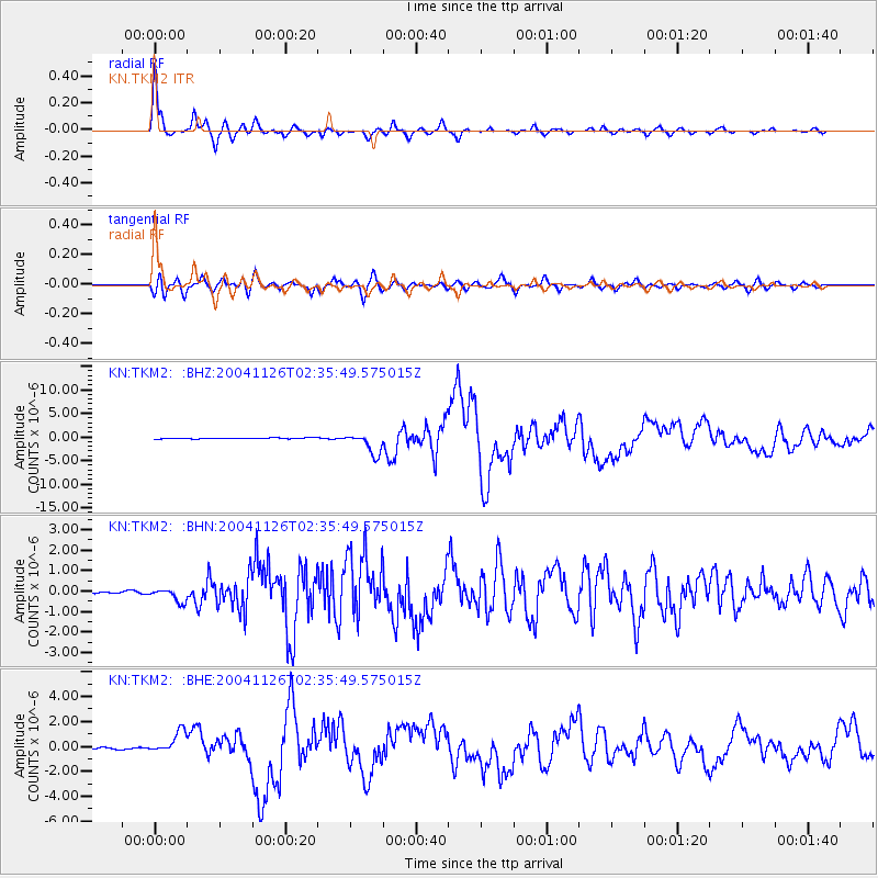
Signal To Noise
| Channel | StoN | STA | LTA |
| KN:TKM2: :BHN:20041126T02:35:49.575015Z | 5.1788545 | 3.2400143E-7 | 6.256238E-8 |
| KN:TKM2: :BHE:20041126T02:35:49.575015Z | 10.264186 | 8.693368E-7 | 8.4696126E-8 |
| KN:TKM2: :BHZ:20041126T02:35:49.575015Z | 25.524065 | 2.258589E-6 | 8.848861E-8 |
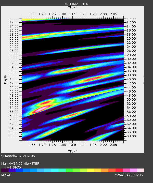
| Arrivals | |
| Ps | 6.2 SECOND |
| PpPs | 22 SECOND |
| PsPs/PpSs | 29 SECOND |

