You are here: Home > Network List > US - United States National Seismic Network Stations List
> Station HAWA Hanford, Washington, USA > Earthquake Result Viewer
HAWA Hanford, Washington, USA - Earthquake Result Viewer
*The percent match for this event was below the threshold and hence no stack was calculated.
| Earthquake location: |
Northern Peru |
| Earthquake latitude/longitude: |
-4.0/-76.9 |
| Earthquake time(UTC): |
2020/06/07 (159) 10:31:17 GMT |
| Earthquake Depth: |
99 km |
| Earthquake Magnitude: |
5.4 Mww |
| Earthquake Catalog/Contributor: |
NEIC PDE/us |
|
| Network: |
US United States National Seismic Network |
| Station: |
HAWA Hanford, Washington, USA |
| Lat/Lon: |
46.39 N/119.53 W |
| Elevation: |
364 m |
|
| Distance: |
62.8 deg |
| Az: |
328.207 deg |
| Baz: |
130.595 deg |
| Ray Param: |
$rayparam |
*The percent match for this event was below the threshold and hence was not used in the summary stack. |
|
| Radial Match: |
41.378746 % |
| Radial Bump: |
400 |
| Transverse Match: |
44.626217 % |
| Transverse Bump: |
400 |
| SOD ConfigId: |
21166931 |
| Insert Time: |
2020-06-21 11:01:14.917 +0000 |
| GWidth: |
2.5 |
| Max Bumps: |
400 |
| Tol: |
0.001 |
|
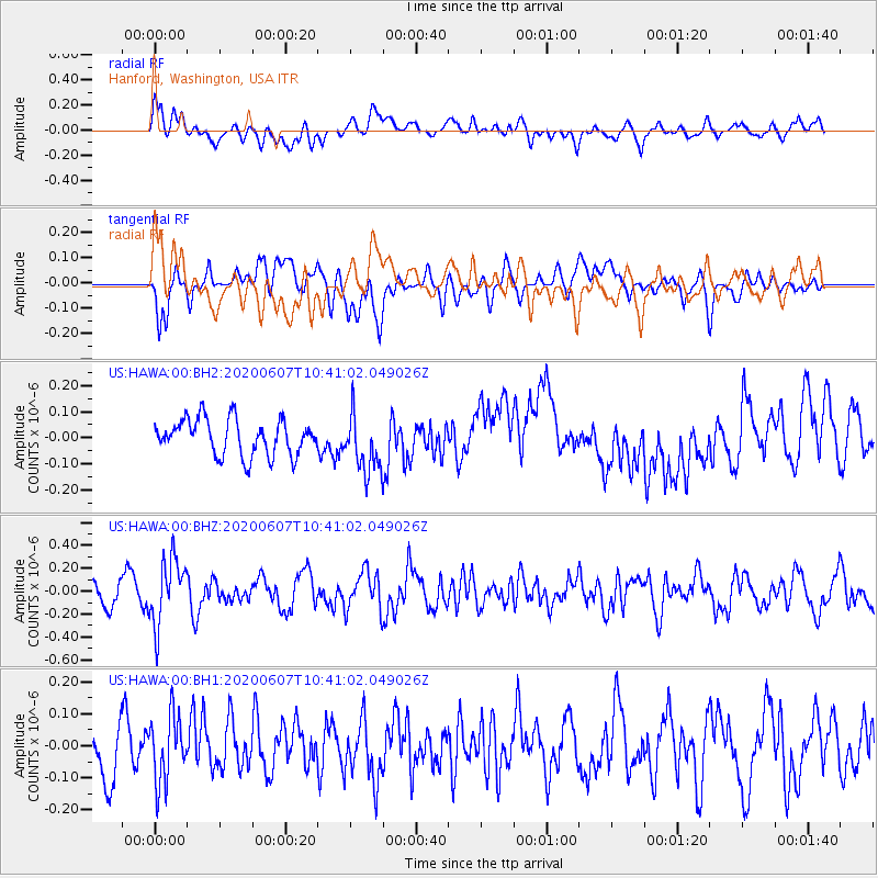
Signal To Noise
| Channel | StoN | STA | LTA |
| US:HAWA:00:BHZ:20200607T10:41:02.049026Z | 1.9187762 | 2.8594692E-7 | 1.4902568E-7 |
| US:HAWA:00:BH1:20200607T10:41:02.049026Z | 1.6230247 | 1.02653004E-7 | 6.324796E-8 |
| US:HAWA:00:BH2:20200607T10:41:02.049026Z | 1.6063129 | 1.1057947E-7 | 6.8840556E-8 |
| Arrivals |
| Ps | |
| PpPs | |
| PsPs/PpSs | |


