TKM2 KN.TKM2 - Earthquake Result Viewer
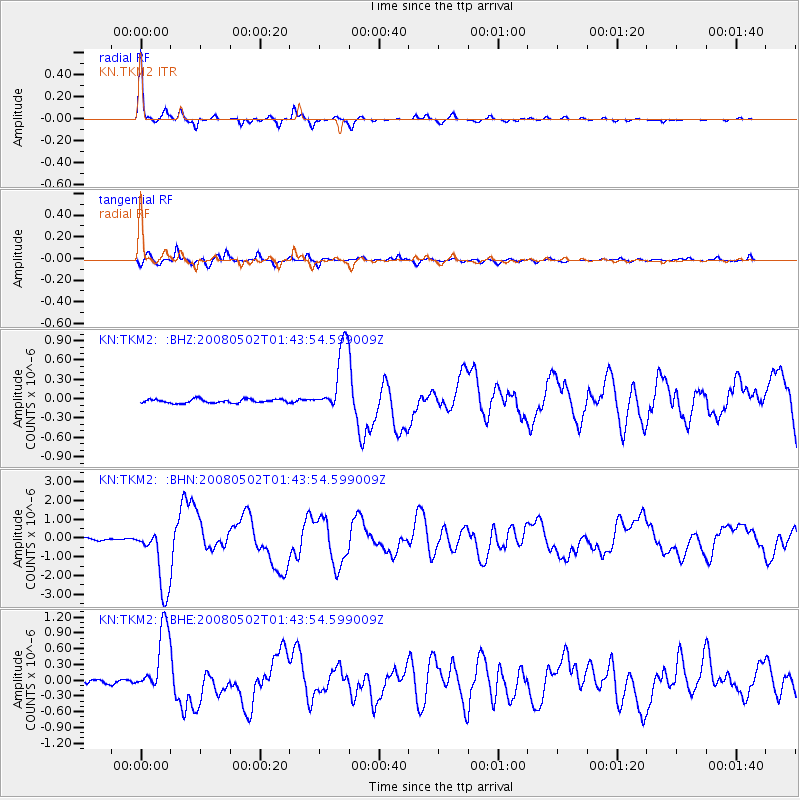
Earthquake location: Andreanof Islands, Aleutian Is.
Earthquake latitude/longitude: 51.9/-177.5
Earthquake time(UTC): 2008/05/02 (123) 01:33:37 GMT
Earthquake Depth: 14 km
Earthquake Magnitude: 6.3 MB, 6.8 MS, 6.6 MW, 6.6 MW
Earthquake Catalog/Contributor: WHDF/NEIC
Network: KN Kyrgyz Seismic Telemetry Network
Station: TKM2 KN.TKM2
Lat/Lon: 42.92 N/75.60 E
Elevation: 2020 m
Distance: 66.4 deg
Az: 309.914 deg
Baz: 40.351 deg
Ray Param: 0.05762254
Estimated Moho Depth: 28.25 km
Estimated Crust Vp/Vs: 1.92
Assumed Crust Vp: 6.306 km/s
Estimated Crust Vs: 3.276 km/s
Estimated Crust Poisson's Ratio: 0.32
Radial Match: 97.08782 %
Radial Bump: 262
Transverse Match: 90.98308 %
Transverse Bump: 400
SOD ConfigId: 2504
Insert Time: 2010-03-08 21:02:43.260 +0000
GWidth: 2.5
Max Bumps: 400
Tol: 0.001

Signal To Noise

ChannelStoNSTALTA
KN:TKM2: :BHN:20080502T01:43:54.599009Z29.5423451.7432932E-65.900998E-8
KN:TKM2: :BHE:20080502T01:43:54.599009Z21.1139956.298491E-72.9830886E-8
KN:TKM2: :BHZ:20080502T01:43:54.599009Z18.0581555.2883775E-72.9285259E-8
Arrivals
Ps4.3 SECOND
PpPs13 SECOND
PsPs/PpSs17 SECOND