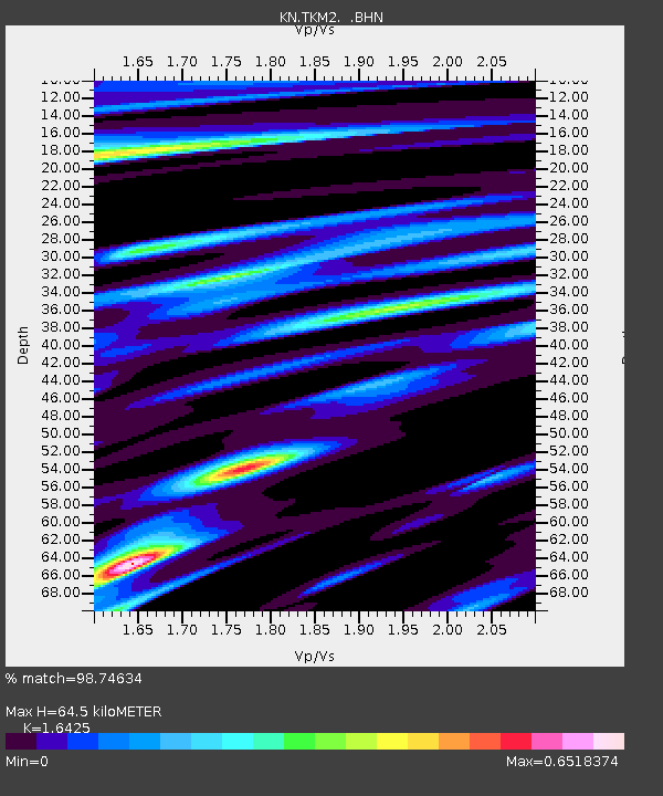
TKM2 KN.TKM2 - Earthquake Result Viewer
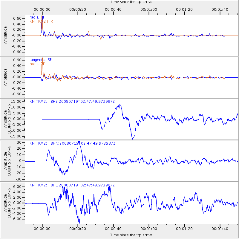
Earthquake location: Off East Coast Of Honshu, Japan
Earthquake latitude/longitude: 37.6/142.2
Earthquake time(UTC): 2008/07/19 (201) 02:39:28 GMT
Earthquake Depth: 22 km
Earthquake Magnitude: 6.2 MB, 7.0 MS, 7.0 MW, 6.9 MW
Earthquake Catalog/Contributor: WHDF/NEIC
Network: KN Kyrgyz Seismic Telemetry Network
Station: TKM2 KN.TKM2
Lat/Lon: 42.92 N/75.60 E
Elevation: 2020 m
Distance: 49.9 deg
Az: 298.254 deg
Baz: 72.373 deg
Ray Param: 0.06834668
Estimated Moho Depth: 64.5 km
Estimated Crust Vp/Vs: 1.64
Assumed Crust Vp: 6.306 km/s
Estimated Crust Vs: 3.839 km/s
Estimated Crust Poisson's Ratio: 0.21
Radial Match: 98.74634 %
Radial Bump: 353
Transverse Match: 94.6108 %
Transverse Bump: 400
SOD ConfigId: 2504
Insert Time: 2010-03-08 21:03:29.201 +0000
GWidth: 2.5
Max Bumps: 400
Tol: 0.001

Signal To Noise

ChannelStoNSTALTA
KN:TKM2: :BHN:20080719T02:47:49.973987Z147.953418.316293E-65.6208865E-8
KN:TKM2: :BHE:20080719T02:47:49.973987Z51.7515681.8144309E-63.5060403E-8
KN:TKM2: :BHZ:20080719T02:47:49.973987Z194.566274.176776E-62.1467114E-8
Arrivals
Ps7.0 SECOND
PpPs25 SECOND
PsPs/PpSs32 SECOND