
TKM2 KN.TKM2 - Earthquake Result Viewer
| ||||||||||||||||||
| ||||||||||||||||||
| ||||||||||||||||||
|
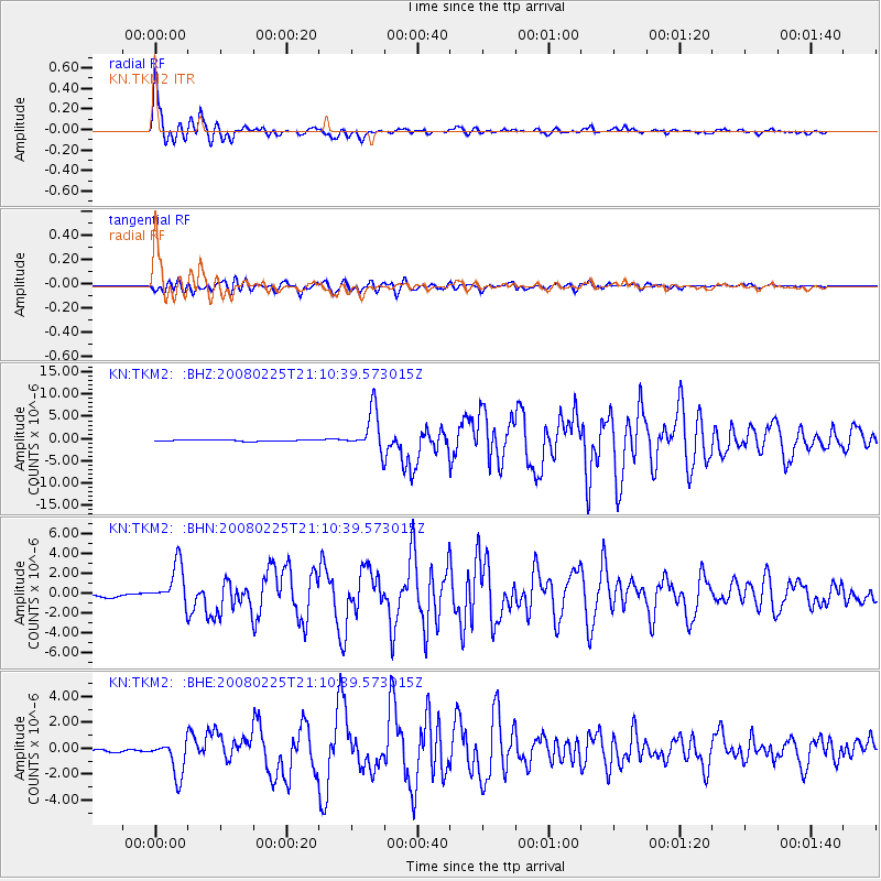
Signal To Noise
| Channel | StoN | STA | LTA |
| KN:TKM2: :BHN:20080225T21:10:39.573015Z | 16.266039 | 2.0889804E-6 | 1.2842588E-7 |
| KN:TKM2: :BHE:20080225T21:10:39.573015Z | 11.700436 | 1.3814039E-6 | 1.1806431E-7 |
| KN:TKM2: :BHZ:20080225T21:10:39.573015Z | 28.024763 | 4.662305E-6 | 1.6636375E-7 |
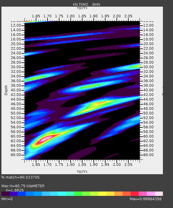
| Arrivals | |
| Ps | 7.1 SECOND |
| PpPs | 24 SECOND |
| PsPs/PpSs | 32 SECOND |

