
TKM2 KN.TKM2 - Earthquake Result Viewer
| ||||||||||||||||||
| ||||||||||||||||||
| ||||||||||||||||||
|
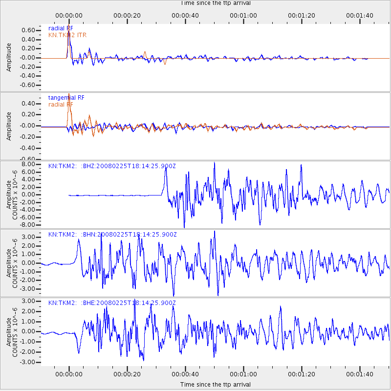
Signal To Noise
| Channel | StoN | STA | LTA |
| KN:TKM2: :BHN:20080225T18:14:25.900Z | 10.054393 | 1.1057041E-6 | 1.0997224E-7 |
| KN:TKM2: :BHE:20080225T18:14:25.900Z | 8.909744 | 7.9148E-7 | 8.8833076E-8 |
| KN:TKM2: :BHZ:20080225T18:14:25.900Z | 51.800713 | 2.592495E-6 | 5.004748E-8 |
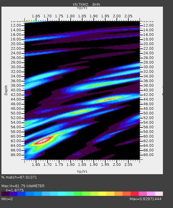
| Arrivals | |
| Ps | 7.0 SECOND |
| PpPs | 25 SECOND |
| PsPs/PpSs | 32 SECOND |

