You are here: Home > Network List > TA - USArray Transportable Network (new EarthScope stations) Stations List
> Station F21K Alatna River, AK, USA > Earthquake Result Viewer
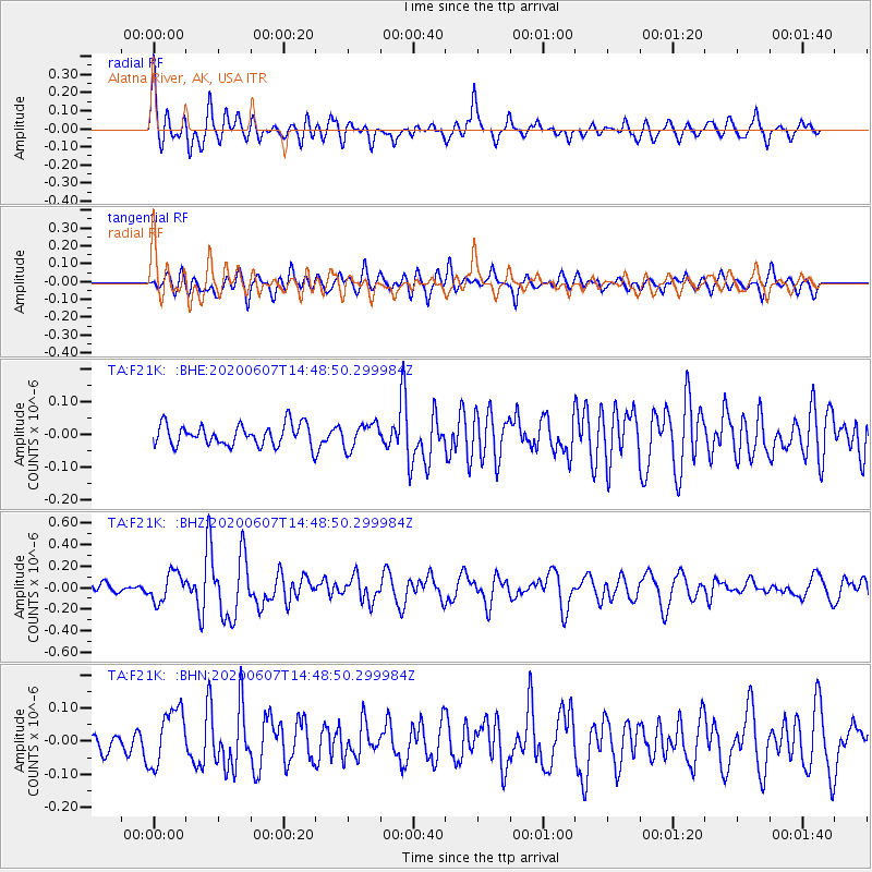
F21K Alatna River, AK, USA - Earthquake Result Viewer
*The percent match for this event was below the threshold and hence no stack was calculated.
| Earthquake location: |
Santa Cruz Islands |
| Earthquake latitude/longitude: |
-10.7/166.1 |
| Earthquake time(UTC): |
2020/06/07 (159) 14:36:56 GMT |
| Earthquake Depth: |
13 km |
| Earthquake Magnitude: |
5.7 mww |
| Earthquake Catalog/Contributor: |
NEIC PDE/us |
|
| Network: |
TA USArray Transportable Network (new EarthScope stations) |
| Station: |
F21K Alatna River, AK, USA |
| Lat/Lon: |
67.22 N/153.48 W |
| Elevation: |
597 m |
|
| Distance: |
83.0 deg |
| Az: |
14.722 deg |
| Baz: |
219.903 deg |
| Ray Param: |
$rayparam |
*The percent match for this event was below the threshold and hence was not used in the summary stack. |
|
| Radial Match: |
79.4889 % |
| Radial Bump: |
400 |
| Transverse Match: |
67.44914 % |
| Transverse Bump: |
400 |
| SOD ConfigId: |
21166931 |
| Insert Time: |
2020-06-21 14:48:38.988 +0000 |
| GWidth: |
2.5 |
| Max Bumps: |
400 |
| Tol: |
0.001 |
|
Signal To Noise
| Channel | StoN | STA | LTA |
| TA:F21K: :BHZ:20200607T14:48:50.299984Z | 3.234151 | 1.3306533E-7 | 4.1143824E-8 |
| TA:F21K: :BHN:20200607T14:48:50.299984Z | 2.6074367 | 8.5482895E-8 | 3.2784264E-8 |
| TA:F21K: :BHE:20200607T14:48:50.299984Z | 1.1938864 | 3.8457184E-8 | 3.2211762E-8 |
| Arrivals |
| Ps | |
| PpPs | |
| PsPs/PpSs | |


