TKM2 KN.TKM2 - Earthquake Result Viewer
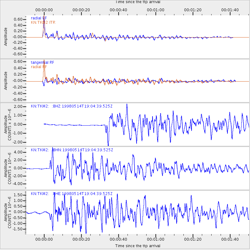
Earthquake location: Off East Coast Of Honshu, Japan
Earthquake latitude/longitude: 40.3/143.3
Earthquake time(UTC): 1998/05/14 (134) 18:56:23 GMT
Earthquake Depth: 33 km
Earthquake Magnitude: 5.8 MB, 5.7 MS, 5.9 UNKNOWN
Earthquake Catalog/Contributor: WHDF/NEIC
Network: KN Kyrgyz Seismic Telemetry Network
Station: TKM2 KN.TKM2
Lat/Lon: 42.92 N/75.60 E
Elevation: 2020 m
Distance: 49.4 deg
Az: 296.554 deg
Baz: 68.742 deg
Ray Param: 0.06864685
Estimated Moho Depth: 12.25 km
Estimated Crust Vp/Vs: 1.60
Assumed Crust Vp: 6.306 km/s
Estimated Crust Vs: 3.941 km/s
Estimated Crust Poisson's Ratio: 0.18
Radial Match: 96.55799 %
Radial Bump: 400
Transverse Match: 91.94578 %
Transverse Bump: 400
SOD ConfigId: 4480
Insert Time: 2010-03-08 21:04:22.612 +0000
GWidth: 2.5
Max Bumps: 400
Tol: 0.001

Signal To Noise

ChannelStoNSTALTA
KN:TKM2: :BHN:19980514T19:04:39.525Z41.176851.7026596E-64.1349924E-8
KN:TKM2: :BHE:19980514T19:04:39.525Z8.2614174.5366667E-75.49139E-8
KN:TKM2: :BHZ:19980514T19:04:39.525Z18.8163727.6763473E-74.0796106E-8
Arrivals
Ps1.2 SECOND
PpPs4.7 SECOND
PsPs/PpSs6.0 SECOND